Area Overview for HP9 1TR
Photos of HP9 1TR
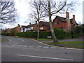
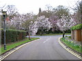
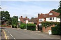
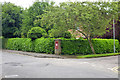

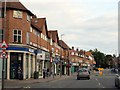
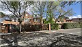
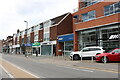
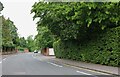
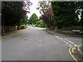
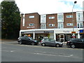
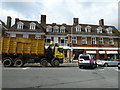
27 photos from this area
Area Information
Key information about the HP9 1TR including its size, population, and administrative classification.
- Area Type
- Postcode
- Area Size
- 4.6 hectares
- Population
- 1679
- Population Density
- 531 people/km²
House Prices in HP9 1TR
38
Properties
£824,992
Average Sold Price
£265,000
Lowest Price
£1,650,000
Highest Price
Showing 38 properties
| Address | Type | Beds | Baths | Last Sale Price | Last Sale Date | |
|---|---|---|---|---|---|---|
| 15 Tilsworth Road, Beaconsfield, HP9 1TR | house | - | - | £1,500,000 | Dec 2022 | |
| 2 Tilsworth Road, Beaconsfield, HP9 1TR | Retail | 5 | 3 | £1,590,000 | Oct 2022 | |
| 17 Tilsworth Road, Beaconsfield, HP9 1TR | house | 6 | 2 | £1,390,000 | Oct 2021 | |
| 31 Tilsworth Road, Beaconsfield, HP9 1TR | house | - | - | £1,251,000 | Jun 2021 | |
| 19 Tilsworth Road, Beaconsfield, HP9 1TR | house | - | - | £945,000 | May 2021 | |
| 1 Tilsworth Road, Beaconsfield, HP9 1TR | house | - | - | £1,650,000 | Mar 2021 | |
| 6 Tilsworth Road, Beaconsfield, HP9 1TR | Detached | 5 | 2 | £1,040,000 | Apr 2019 | |
| 3 Tilsworth Road, Beaconsfield, HP9 1TR | Detached | 4 | 1 | £900,000 | Oct 2017 | |
| 8 Tilsworth Road, Beaconsfield, HP9 1TR | house | - | - | £975,000 | Jul 2016 | |
| 43 Tilsworth Road, Beaconsfield, HP9 1TR | house | 4 | 1 | £765,300 | Oct 2014 |
Page 1 of 4
Energy Efficiency in HP9 1TR
Amenities
Schools
| Rank | School | Type | Entry gender | Ages |
|---|
Explore more schools in this area
Go to Schools tabDemographics
Household Size
Family (3-5 people)
most common
Accommodation Type
Houses
most common
Tenure
86
majority
Ethnic Group
White
most common
Religion
N/A
most common
Household Composition
N/A
most common
Age
47
median
Adults (30-64 years)
most common
Household Deprivation
N/A
with no deprivation
NS-SEC
59
in Lower managerial occupations
Explore more demographic insights in this area
Go to Demographics tabPlanning
Planning Constraints
- Flood RiskPremium
- Ramsar Wetland SitesPremium
- Area of Outstanding Natural BeautyPremium
- Protected Nature ReservePremium
- Protected WoodlandPremium