Area Overview for HP9 1SU
Photos of HP9 1SU
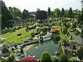
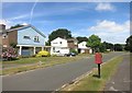
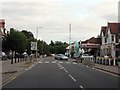
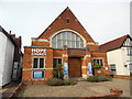
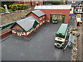
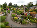
100 photos from this area
Area Information
Key information about the HP9 1SU including its size, population, and administrative classification.
- Area Type
- Postcode
- Area Size
- 2.1 hectares
- Population
- 1819
- Population Density
- 346 people/km²
House Prices in HP9 1SU
18
Properties
£851,848
Average Sold Price
£207,000
Lowest Price
£1,946,713
Highest Price
Showing 18 properties
| Address | Type | Beds | Baths | Last Sale Price | Last Sale Date | |
|---|---|---|---|---|---|---|
| 22 Seagrave Road, Beaconsfield, HP9 1SU | Detached | 4 | 2 | £950,000 | May 2025 | |
| 16 Seagrave Road, Beaconsfield, HP9 1SU | Detached | 4 | 2 | £1,050,000 | Feb 2025 | |
| 20 Seagrave Road, Beaconsfield, HP9 1SU | house | - | - | £930,000 | Aug 2024 | |
| 4 Seagrave Road, Beaconsfield, HP9 1SU | Bungalow | 3 | 1 | £900,000 | Nov 2023 | |
| 12 Seagrave Road, Beaconsfield, HP9 1SU | Detached | 4 | 2 | £1,150,000 | Apr 2023 | |
| 3 Seagrave Road, Beaconsfield, HP9 1SU | Detached | 5 | 2 | £955,000 | Mar 2020 | |
| 9 Seagrave Road, Beaconsfield, HP9 1SU | Bungalow | - | - | £1,946,713 | Aug 2017 | |
| 14 Seagrave Road, Beaconsfield, HP9 1SU | Detached | 4 | 3 | £850,000 | Nov 2014 | |
| 7 Seagrave Road, Beaconsfield, HP9 1SU | house | - | - | £655,000 | Jun 2013 | |
| 15 Seagrave Road, Beaconsfield, HP9 1SU | Detached | - | - | £589,000 | Jul 2012 |
Page 1 of 2
Energy Efficiency in HP9 1SU
Amenities
Schools
| Rank | School | Type | Entry gender | Ages |
|---|
Explore more schools in this area
Go to Schools tabDemographics
Household Size
Two person
most common
Accommodation Type
Houses
most common
Tenure
84
majority
Ethnic Group
White
most common
Religion
N/A
most common
Household Composition
N/A
most common
Age
47
median
Adults (30-64 years)
most common
Household Deprivation
N/A
with no deprivation
NS-SEC
59
in Lower managerial occupations
Explore more demographic insights in this area
Go to Demographics tabPlanning
Planning Constraints
- Flood RiskPremium
- Ramsar Wetland SitesPremium
- Area of Outstanding Natural BeautyPremium
- Protected Nature ReservePremium
- Protected WoodlandPremium