Area Overview for HP9 1SQ
Photos of HP9 1SQ
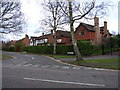
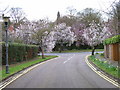
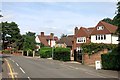
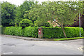
27 photos from this area
Area Information
Key information about the HP9 1SQ including its size, population, and administrative classification.
- Area Type
- Postcode
- Area Size
- 6.0 hectares
- Population
- 2177
- Population Density
- 1673 people/km²
House Prices in HP9 1SQ
28
Properties
£623,335
Average Sold Price
£197,000
Lowest Price
£1,250,000
Highest Price
Showing 28 properties
| Address | Type | Beds | Baths | Last Sale Price | Last Sale Date | |
|---|---|---|---|---|---|---|
| 45 Butlers Court Road, Beaconsfield, HP9 1SQ | house | 4 | 1 | £1,250,000 | Apr 2022 | |
| 27 Butlers Court Road, Beaconsfield, HP9 1SQ | house | - | - | £1,140,000 | Feb 2021 | |
| 37 Butlers Court Road, Beaconsfield, HP9 1SQ | house | - | - | £1,000,000 | Aug 2019 | |
| 57 Butlers Court Road, Beaconsfield, HP9 1SQ | Detached | 4 | 1 | £662,000 | Mar 2014 | |
| 65 Butlers Court Road, Beaconsfield, HP9 1SQ | Detached | 4 | 2 | £780,000 | Feb 2014 | |
| 43 Butlers Court Road, Beaconsfield, HP9 1SQ | house | - | - | £775,200 | Sep 2011 | |
| 41 Butlers Court Road, Beaconsfield, HP9 1SQ | house | - | - | £633,000 | Feb 2010 | |
| 33 Butlers Court Road, Beaconsfield, HP9 1SQ | Semi-detached | - | - | £575,000 | Jul 2009 | |
| 49 Butlers Court Road, Beaconsfield, HP9 1SQ | Detached | - | - | £600,657 | Apr 2008 | |
| 39 Butlers Court Road, Beaconsfield, HP9 1SQ | Semi-detached | - | - | £577,000 | Dec 2006 |
Page 1 of 3
Energy Efficiency in HP9 1SQ
Amenities
Schools
| Rank | School | Type | Entry gender | Ages |
|---|
Explore more schools in this area
Go to Schools tabDemographics
Household Size
Family (3-5 people)
most common
Accommodation Type
Houses
most common
Tenure
70
majority
Ethnic Group
White
most common
Religion
N/A
most common
Household Composition
N/A
most common
Age
47
median
Adults (30-64 years)
most common
Household Deprivation
N/A
with no deprivation
NS-SEC
54
in Lower managerial occupations
Explore more demographic insights in this area
Go to Demographics tabPlanning
Planning Constraints
- Flood RiskPremium
- Ramsar Wetland SitesPremium
- Area of Outstanding Natural BeautyPremium
- Protected Nature ReservePremium
- Protected WoodlandPremium