Area Overview for HP7 0LB
Photos of HP7 0LB
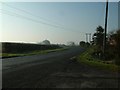
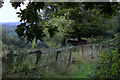
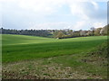
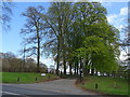
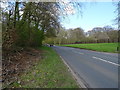
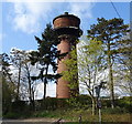
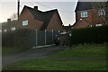
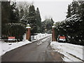
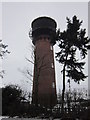
16 photos from this area
Area Information
Key information about the HP7 0LB including its size, population, and administrative classification.
- Area Type
- Postcode
- Area Size
- 54.4 hectares
- Population
- 1559
- Population Density
- 92 people/km²
House Prices in HP7 0LB
24
Properties
£1,509,063
Average Sold Price
£587,500
Lowest Price
£4,775,000
Highest Price
Showing 24 properties
| Address | Type | Beds | Baths | Last Sale Price | Last Sale Date | |
|---|---|---|---|---|---|---|
| Orchard House, Tower Road, Coleshill, HP7 0LB | house | 5 | 5 | £4,775,000 | Oct 2024 | |
| Meadow View Cottage, Tower Road, Coleshill, HP7 0LB | Detached | 5 | 3 | £905,000 | Apr 2023 | |
| RED COTTAGE, TOWER ROAD, Coleshill, HP7 0LB | Detached | 4 | 3 | £2,350,000 | Sep 2022 | |
| Springfield, Tower Road, Coleshill, HP7 0LB | Detached | 4 | 4 | £950,000 | Jun 2021 | |
| Solon, Tower Road, Coleshill, HP7 0LB | Detached | 5 | 3 | £845,000 | Oct 2011 | |
| Sandycroft, Tower Road, Coleshill, HP7 0LB | house | 3 | - | £750,000 | Aug 2011 | |
| Ambleside, Tower Road, Coleshill, HP7 0LB | house | 5 | - | £910,000 | Dec 2010 | |
| Grays Cottage, Tower Road, Coleshill, HP7 0LB | Semi-detached | - | - | £587,500 | Aug 2006 | |
| Annexe, Oak Tree Cottage, Tower Road, Coleshill, HP7 0LB | Detached | 5 | 3 | - | - | |
| The Rosary, Tower Road, Coleshill, HP7 0LB | Detached | 6 | 4 | - | - |
Page 1 of 3
Energy Efficiency in HP7 0LB
Amenities
Schools
| Rank | School | Type | Entry gender | Ages |
|---|
Explore more schools in this area
Go to Schools tabDemographics
Household Size
Two person
most common
Accommodation Type
Houses
most common
Tenure
79
majority
Ethnic Group
White
most common
Religion
N/A
most common
Household Composition
N/A
most common
Age
47
median
Adults (30-64 years)
most common
Household Deprivation
N/A
with no deprivation
NS-SEC
49
in Lower managerial occupations
Explore more demographic insights in this area
Go to Demographics tabPlanning
Planning Constraints
- Flood RiskPremium
- Ramsar Wetland SitesPremium
- Area of Outstanding Natural BeautyPremium
- Protected Nature ReservePremium
- Protected WoodlandPremium