Area Overview for HP6 6RN
Photos of HP6 6RN

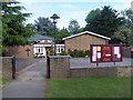
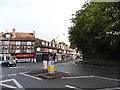

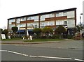
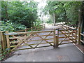

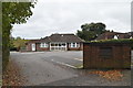
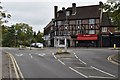

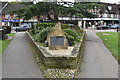

96 photos from this area
Area Information
Key information about the HP6 6RN including its size, population, and administrative classification.
- Area Type
- Postcode
- Area Size
- 1.8 hectares
- Population
- 1803
- Population Density
- 1780 people/km²
House Prices in HP6 6RN
20
Properties
£551,038
Average Sold Price
£139,500
Lowest Price
£807,000
Highest Price
Showing 20 properties
| Address | Type | Beds | Baths | Last Sale Price | Last Sale Date | |
|---|---|---|---|---|---|---|
| 39 Westwood Drive, Little Chalfont, HP6 6RN | house | - | - | £807,000 | Jun 2021 | |
| 60 Westwood Drive, Little Chalfont, HP6 6RN | house | - | - | £700,000 | Dec 2020 | |
| 41 Westwood Drive, Little Chalfont, HP6 6RN | Semi-detached | 3 | 1 | £676,000 | Jul 2018 | |
| 33 Westwood Drive, Little Chalfont, HP6 6RN | Semi-detached | 3 | 2 | £650,000 | Apr 2018 | |
| 27 Westwood Drive, Little Chalfont, HP6 6RN | Semi-detached | 3 | 1 | £595,000 | Apr 2017 | |
| 31 Westwood Drive, Little Chalfont, HP6 6RN | Semi-detached | 4 | 2 | £605,000 | Apr 2017 | |
| 62 Westwood Drive, Little Chalfont, HP6 6RN | Semi-detached | 4 | 2 | £668,000 | Aug 2016 | |
| 66 Westwood Drive, Little Chalfont, HP6 6RN | Semi-detached | 4 | 2 | £645,000 | Dec 2014 | |
| 25 Westwood Drive, Little Chalfont, HP6 6RN | Semi-detached | 4 | 1 | £490,000 | Dec 2013 | |
| 29 Westwood Drive, Little Chalfont, HP6 6RN | Semi-detached | 4 | 2 | £453,000 | May 2012 |
Page 1 of 2
Energy Efficiency in HP6 6RN
Amenities
Schools
| Rank | School | Type | Entry gender | Ages |
|---|
Explore more schools in this area
Go to Schools tabDemographics
Household Size
Family (3-5 people)
most common
Accommodation Type
Houses
most common
Tenure
89
majority
Ethnic Group
White
most common
Religion
N/A
most common
Household Composition
N/A
most common
Age
47
median
Adults (30-64 years)
most common
Household Deprivation
N/A
with no deprivation
NS-SEC
59
in Lower managerial occupations
Explore more demographic insights in this area
Go to Demographics tabPlanning
Planning Constraints
- Flood RiskPremium
- Ramsar Wetland SitesPremium
- Area of Outstanding Natural BeautyPremium
- Protected Nature ReservePremium
- Protected WoodlandPremium