Area Overview for HP5 3LA
Photos of HP5 3LA
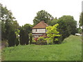
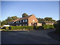
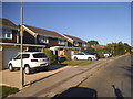
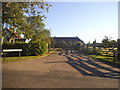
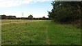
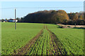
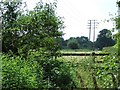
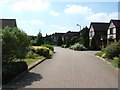
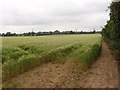
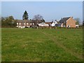
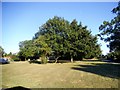
11 photos from this area
Area Information
Key information about the HP5 3LA including its size, population, and administrative classification.
- Area Type
- Postcode
- Area Size
- 7.3 hectares
- Population
- 1443
- Population Density
- 1167 people/km²
House Prices in HP5 3LA
26
Properties
£601,297
Average Sold Price
£159,000
Lowest Price
£1,300,000
Highest Price
Showing 26 properties
| Address | Type | Beds | Baths | Last Sale Price | Last Sale Date | |
|---|---|---|---|---|---|---|
| Corberley, Lycrome Road, Chesham, HP5 3LA | Detached | 6 | 2 | £1,065,000 | Dec 2024 | |
| 10 Lycrome Road, Chesham, HP5 3LA | Semi-detached | 3 | 2 | £460,000 | Aug 2023 | |
| Nashleigh Lodge, Lycrome Road, Chesham, HP5 3LA | Retail | 6 | 3 | £1,300,000 | May 2022 | |
| 8 Lycrome Road, Chesham, HP5 3LA | Detached | 3 | 1 | £580,000 | Dec 2021 | |
| Hills And Holes, Lycrome Road, Chesham, HP5 3LA | Detached | 4 | - | £725,000 | Oct 2018 | |
| Halcyon, Lycrome Road, Chesham, HP5 3LA | Bungalow | 4 | - | £862,500 | Apr 2016 | |
| Cool Gales, Lycrome Road, Chesham, HP5 3LA | Detached | 5 | 4 | £670,000 | Jul 2015 | |
| Sunnymede, Lycrome Road, Chesham, HP5 3LA | house | - | - | £715,000 | Nov 2014 | |
| Ambleside, Lycrome Road, Chesham, HP5 3LA | house | - | - | £396,500 | Jun 2012 | |
| 11 Lycrome Road, Chesham, HP5 3LA | house | 4 | - | £442,500 | Apr 2012 |
Page 1 of 3
Energy Efficiency in HP5 3LA
Amenities
Schools
| Rank | School | Type | Entry gender | Ages |
|---|
Explore more schools in this area
Go to Schools tabDemographics
Household Size
Family (3-5 people)
most common
Accommodation Type
Houses
most common
Tenure
84
majority
Ethnic Group
White
most common
Religion
N/A
most common
Household Composition
N/A
most common
Age
47
median
Adults (30-64 years)
most common
Household Deprivation
N/A
with no deprivation
NS-SEC
46
in Lower managerial occupations
Explore more demographic insights in this area
Go to Demographics tabPlanning
Planning Constraints
- Flood RiskPremium
- Ramsar Wetland SitesPremium
- Area of Outstanding Natural BeautyPremium
- Protected Nature ReservePremium
- Protected WoodlandPremium