Area Overview for HP5 2UQ
Photos of HP5 2UQ
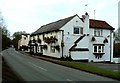
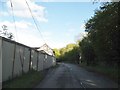
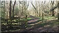
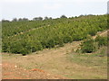
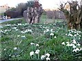
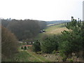

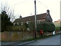


10 photos from this area
Area Information
Key information about the HP5 2UQ including its size, population, and administrative classification.
- Area Type
- Postcode
- Area Size
- 44.4 hectares
- Population
- 2306
- Population Density
- 92 people/km²
House Prices in HP5 2UQ
33
Properties
£777,706
Average Sold Price
£425,000
Lowest Price
£1,360,000
Highest Price
Showing 33 properties
| Address | Type | Beds | Baths | Last Sale Price | Last Sale Date | |
|---|---|---|---|---|---|---|
| Hawthorn Cottage, Hawridge Common, Hawridge, HP5 2UQ | Detached | 4 | 3 | £810,000 | Sep 2025 | |
| Meadow Sweet, Hawridge Common, Hawridge, HP5 2UQ | Detached | 4 | 2 | £1,075,000 | Mar 2025 | |
| Bracken View, Hawridge Common, Hawridge, HP5 2UQ | Terraced | 3 | 1 | £590,000 | Jan 2025 | |
| Box Tree Cottage, Hawridge Common, Hawridge, HP5 2UQ | Detached | - | - | £971,000 | May 2022 | |
| Crown Cottage, Hawridge Common, Hawridge, HP5 2UQ | house | 4 | 3 | £700,000 | Jan 2022 | |
| May Cottage, Hawridge Common, Hawridge, HP5 2UQ | Terraced | - | - | £885,000 | Sep 2021 | |
| Rose Cottage, Hawridge Common, Hawridge, HP5 2UQ | Terraced | 4 | 3 | £745,000 | Sep 2021 | |
| Ridge Cottage, Hawridge Common, Hawridge, HP5 2UQ | house | 3 | - | £520,000 | Mar 2017 | |
| The Old Smithy, Hawridge Common, Hawridge, HP5 2UQ | house | 5 | - | £1,105,000 | Nov 2015 | |
| Gateways, Hawridge Common, Hawridge, HP5 2UQ | Detached | 2 | 1 | £675,000 | Jun 2015 |
Page 1 of 4
Energy Efficiency in HP5 2UQ
Amenities
Schools
| Rank | School | Type | Entry gender | Ages |
|---|
Explore more schools in this area
Go to Schools tabDemographics
Household Size
Two person
most common
Accommodation Type
Houses
most common
Tenure
86
majority
Ethnic Group
White
most common
Religion
N/A
most common
Household Composition
N/A
most common
Age
47
median
Adults (30-64 years)
most common
Household Deprivation
N/A
with no deprivation
NS-SEC
48
in Lower managerial occupations
Explore more demographic insights in this area
Go to Demographics tabPlanning
Planning Constraints
- Flood RiskPremium
- Ramsar Wetland SitesPremium
- Area of Outstanding Natural BeautyPremium
- Protected Nature ReservePremium
- Protected WoodlandPremium