Area Overview for HP5 2HA
Photos of HP5 2HA
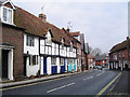
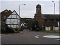
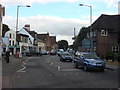
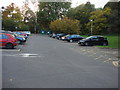
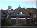
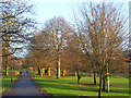
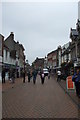
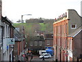
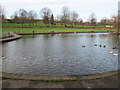
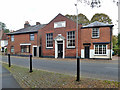
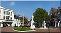
100 photos from this area
Area Information
Key information about the HP5 2HA including its size, population, and administrative classification.
- Area Type
- Postcode
- Area Size
- 1.8 hectares
- Population
- 1693
- Population Density
- 4808 people/km²
House Prices in HP5 2HA
26
Properties
£306,532
Average Sold Price
£66,000
Lowest Price
£585,000
Highest Price
Showing 26 properties
| Address | Type | Beds | Baths | Last Sale Price | Last Sale Date | |
|---|---|---|---|---|---|---|
| Quaker Hill House, 68 Bellingdon Road, Chesham, HP5 2HA | Semi-detached | 3 | 1 | £585,000 | Jul 2025 | |
| 52 Bellingdon Road, Chesham, HP5 2HA | Terraced | 4 | 1 | £440,000 | Aug 2022 | |
| 38 Bellingdon Road, Chesham, HP5 2HA | house | - | - | £313,000 | May 2021 | |
| 64 Bellingdon Road, Chesham, HP5 2HA | house | 3 | - | £465,000 | Feb 2017 | |
| 36 Bellingdon Road, Chesham, HP5 2HA | house | - | - | £420,000 | Aug 2016 | |
| 3, Dollings Yard, Bellingdon Road, Chesham, HP5 2HA | Terraced | 2 | 1 | £335,000 | Oct 2014 | |
| 50 Bellingdon Road, Chesham, HP5 2HA | Terraced | 3 | - | £250,000 | Nov 2013 | |
| 42 Bellingdon Road, Chesham, HP5 2HA | Semi-detached | 3 | - | £250,000 | May 2013 | |
| 48 Bellingdon Road, Chesham, HP5 2HA | Terraced | 3 | 2 | £249,950 | Aug 2010 | |
| Quaker Hill Cottage, 66 Bellingdon Road, Chesham, HP5 2HA | house | - | - | £200,000 | Jan 2009 |
Page 1 of 3
Energy Efficiency in HP5 2HA
Amenities
Schools
| Rank | School | Type | Entry gender | Ages |
|---|
Explore more schools in this area
Go to Schools tabDemographics
Household Size
One person
most common
Accommodation Type
Houses
most common
Tenure
54
majority
Ethnic Group
White
most common
Religion
N/A
most common
Household Composition
N/A
most common
Age
47
median
Adults (30-64 years)
most common
Household Deprivation
N/A
with no deprivation
NS-SEC
38
in Lower managerial occupations
Explore more demographic insights in this area
Go to Demographics tabPlanning
Planning Constraints
- Flood RiskPremium
- Ramsar Wetland SitesPremium
- Area of Outstanding Natural BeautyPremium
- Protected Nature ReservePremium
- Protected WoodlandPremium