Area Overview for HP5 2DP
Photos of HP5 2DP
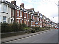

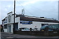
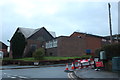
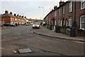
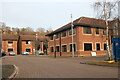
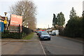
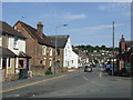
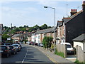

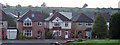
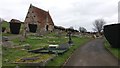
15 photos from this area
Area Information
Key information about the HP5 2DP including its size, population, and administrative classification.
- Area Type
- Postcode
- Area Size
- 1.3 hectares
- Population
- 2285
- Population Density
- 1888 people/km²
House Prices in HP5 2DP
30
Properties
£236,688
Average Sold Price
£84,000
Lowest Price
£400,000
Highest Price
Showing 30 properties
| Address | Type | Beds | Baths | Last Sale Price | Last Sale Date | |
|---|---|---|---|---|---|---|
| 5 Pond Park Road, Chesham, HP5 2DP | house | - | - | £219,000 | Sep 2020 | |
| 1F Pond Park Road, Chesham, HP5 2DP | Semi-detached | 3 | 2 | £400,000 | Jul 2018 | |
| Palma, 1A Pond Park Road, Chesham, HP5 2DP | Semi-detached | 3 | - | £357,000 | Aug 2017 | |
| 1D Pond Park Road, Chesham, HP5 2DP | Semi-detached | 3 | 3 | £365,000 | Sep 2015 | |
| 1E Pond Park Road, Chesham, HP5 2DP | house | - | - | £355,000 | Jun 2015 | |
| 1C Pond Park Road, Chesham, HP5 2DP | Semi-detached | 3 | 2 | £390,000 | Apr 2015 | |
| 21 Pond Park Road, Chesham, HP5 2DP | Semi-detached | 3 | 1 | £195,000 | Oct 2007 | |
| 18 Pond Park Road, Chesham, HP5 2DP | Semi-detached | - | - | £191,000 | Jun 2005 | |
| 15 Pond Park Road, Chesham, HP5 2DP | house | - | - | £174,950 | Apr 2003 | |
| 24 Pond Park Road, Chesham, HP5 2DP | house | - | - | £128,000 | Oct 2001 |
Page 1 of 3
Energy Efficiency in HP5 2DP
Amenities
Schools
| Rank | School | Type | Entry gender | Ages |
|---|
Explore more schools in this area
Go to Schools tabDemographics
Household Size
Family (3-5 people)
most common
Accommodation Type
Houses
most common
Tenure
67
majority
Ethnic Group
White
most common
Religion
N/A
most common
Household Composition
N/A
most common
Age
47
median
Adults (30-64 years)
most common
Household Deprivation
N/A
with no deprivation
NS-SEC
32
in Lower managerial occupations
Explore more demographic insights in this area
Go to Demographics tabPlanning
Planning Constraints
- Flood RiskPremium
- Ramsar Wetland SitesPremium
- Area of Outstanding Natural BeautyPremium
- Protected Nature ReservePremium
- Protected WoodlandPremium