Area Overview for HP27 9SE
Photos of HP27 9SE
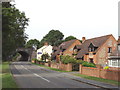
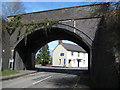
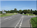
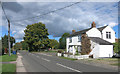
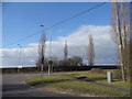
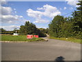
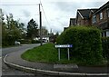
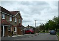
15 photos from this area
Area Information
Key information about the HP27 9SE including its size, population, and administrative classification.
- Area Type
- Postcode
- Area Size
- 2.9 hectares
- Population
- 2142
- Population Density
- 124 people/km²
House Prices in HP27 9SE
33
Properties
£492,372
Average Sold Price
£185,000
Lowest Price
£775,000
Highest Price
Showing 33 properties
| Address | Type | Beds | Baths | Last Sale Price | Last Sale Date | |
|---|---|---|---|---|---|---|
| 22 Bell Crescent, Longwick, HP27 9SE | Detached | 4 | - | £667,500 | Dec 2024 | |
| 32 Bell Crescent, Longwick, HP27 9SE | Detached | 5 | 2 | £752,500 | Oct 2024 | |
| Roses, 12A Bell Crescent, Longwick, HP27 9SE | Bungalow | 3 | - | £580,000 | Sep 2022 | |
| 38 Bell Crescent, Longwick, HP27 9SE | Detached | 4 | 2 | £610,000 | Aug 2022 | |
| 42 Bell Crescent, Longwick, HP27 9SE | Detached | 5 | 3 | £775,000 | Aug 2022 | |
| 5 Bell Crescent, Longwick, HP27 9SE | house | - | - | £600,000 | Feb 2018 | |
| 8 Bell Crescent, Longwick, HP27 9SE | Bungalow | 4 | 2 | £525,000 | May 2017 | |
| 4 Bell Crescent, Longwick, HP27 9SE | Bungalow | - | - | £530,000 | Feb 2017 | |
| 36 Bell Crescent, Longwick, HP27 9SE | Detached | 5 | - | £530,000 | Aug 2015 | |
| 20 Bell Crescent, Longwick, HP27 9SE | Detached | 4 | - | £552,000 | Dec 2014 |
Page 1 of 4
Energy Efficiency in HP27 9SE
Amenities
Schools
| Rank | School | Type | Entry gender | Ages |
|---|
Explore more schools in this area
Go to Schools tabDemographics
Household Size
Two person
most common
Accommodation Type
Houses
most common
Tenure
80
majority
Ethnic Group
White
most common
Religion
N/A
most common
Household Composition
N/A
most common
Age
47
median
Adults (30-64 years)
most common
Household Deprivation
N/A
with no deprivation
NS-SEC
48
in Lower managerial occupations
Explore more demographic insights in this area
Go to Demographics tabPlanning
Planning Constraints
- Flood RiskPremium
- Ramsar Wetland SitesPremium
- Area of Outstanding Natural BeautyPremium
- Protected Nature ReservePremium
- Protected WoodlandPremium