Area Overview for HP27 9QS
Photos of HP27 9QS
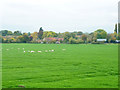
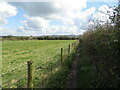
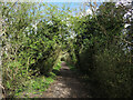
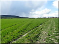
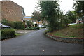
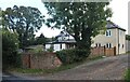
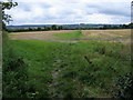

20 photos from this area
Area Information
Key information about the HP27 9QS including its size, population, and administrative classification.
- Area Type
- Postcode
- Area Size
- 19.0 hectares
- Population
- 1542
- Population Density
- 72 people/km²
House Prices in HP27 9QS
11
Properties
£585,222
Average Sold Price
£185,000
Lowest Price
£1,460,000
Highest Price
Showing 11 properties
| Address | Type | Beds | Baths | Last Sale Price | Last Sale Date | |
|---|---|---|---|---|---|---|
| Little Acre, Perry Lane, Bledlow, HP27 9QS | Bungalow | 4 | 2 | £900,000 | Sep 2024 | |
| Wincroft, Perry Lane, Bledlow, HP27 9QS | Detached | 4 | 3 | £1,460,000 | Sep 2023 | |
| Letter Box House, 43 Perry Lane, Bledlow, HP27 9QS | Semi-detached | 3 | 1 | £490,000 | Jun 2021 | |
| Tryfan, Perry Lane, Bledlow, HP27 9QS | house | 5 | - | £745,000 | Jun 2021 | |
| The Rowan, Perry Lane, Bledlow, HP27 9QS | Detached | 4 | 2 | £470,000 | Mar 2007 | |
| Edgefield House, Perry Lane, Bledlow, HP27 9QS | Semi-detached | 3 | 1 | £500,000 | Sep 2006 | |
| Saddlestones, Perry Lane, Bledlow, HP27 9QS | Semi-detached | - | - | £282,000 | Jan 2004 | |
| Chilterns Edge, Perry Lane, Bledlow, HP27 9QS | Detached | 4 | 2 | £235,000 | Jun 1997 | |
| Rannerdale, Perry Lane, Bledlow, HP27 9QS | Detached | - | - | £185,000 | Nov 1996 | |
| Secunda Fortuna, Perry Lane, Bledlow, HP27 9QS | Detached | 3 | 1 | - | - |
Page 1 of 2
Energy Efficiency in HP27 9QS
Amenities
Schools
| Rank | School | Type | Entry gender | Ages |
|---|
Explore more schools in this area
Go to Schools tabDemographics
Household Size
Two person
most common
Accommodation Type
Houses
most common
Tenure
82
majority
Ethnic Group
White
most common
Religion
N/A
most common
Household Composition
N/A
most common
Age
47
median
Adults (30-64 years)
most common
Household Deprivation
N/A
with no deprivation
NS-SEC
46
in Lower managerial occupations
Explore more demographic insights in this area
Go to Demographics tabPlanning
Planning Constraints
- Flood RiskPremium
- Ramsar Wetland SitesPremium
- Area of Outstanding Natural BeautyPremium
- Protected Nature ReservePremium
- Protected WoodlandPremium