Area Overview for HP27 9QB
Photos of HP27 9QB
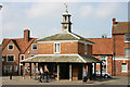
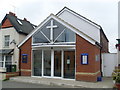
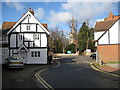
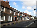
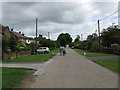
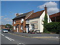
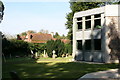

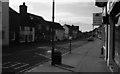
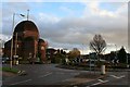
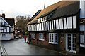
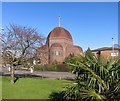
85 photos from this area
Area Information
Key information about the HP27 9QB including its size, population, and administrative classification.
- Area Type
- Postcode
- Area Size
- 24.7 hectares
- Population
- 1856
- Population Density
- 614 people/km²
House Prices in HP27 9QB
11
Properties
£472,357
Average Sold Price
£163,500
Lowest Price
£839,500
Highest Price
Showing 11 properties
| Address | Type | Beds | Baths | Last Sale Price | Last Sale Date | |
|---|---|---|---|---|---|---|
| Park Mill House, Park Mill, Princes Risborough, HP27 9QB | house | - | - | £839,500 | Jul 2025 | |
| Little Mill House, Park Mill, Princes Risborough, HP27 9QB | Terraced | 3 | 2 | £610,000 | Oct 2024 | |
| 52 Summerleys Road, Princes Risborough, HP27 9QB | house | - | - | £520,000 | Sep 2022 | |
| Millcroft, Park Mill, Princes Risborough, HP27 9QB | house | - | - | £445,000 | May 2012 | |
| Old Stocks, Park Mill, Princes Risborough, HP27 9QB | Detached | 4 | 2 | £418,500 | Apr 2007 | |
| Acorns, Summerleys Road, Princes Risborough, HP27 9QB | Detached | - | - | £310,000 | Jul 2002 | |
| Mill Stream House, Park Mill, Princes Risborough, HP27 9QB | Terraced | - | - | £163,500 | Aug 1995 | |
| Little Mill Stables, Park Mill, Princes Risborough, HP27 9QB | Retail | 1 | 1 | - | - | |
| Newlands, Park Mill, Princes Risborough, HP27 9QB | Detached | - | - | - | - | |
| Park Mill Farm, Park Mill, Princes Risborough, HP27 9QB | Farm | - | - | - | - |
Page 1 of 2
Energy Efficiency in HP27 9QB
Amenities
Schools
| Rank | School | Type | Entry gender | Ages |
|---|
Explore more schools in this area
Go to Schools tabDemographics
Household Size
Two person
most common
Accommodation Type
Houses
most common
Tenure
87
majority
Ethnic Group
White
most common
Religion
N/A
most common
Household Composition
N/A
most common
Age
47
median
Adults (30-64 years)
most common
Household Deprivation
N/A
with no deprivation
NS-SEC
56
in Lower managerial occupations
Explore more demographic insights in this area
Go to Demographics tabPlanning
Planning Constraints
- Flood RiskPremium
- Ramsar Wetland SitesPremium
- Area of Outstanding Natural BeautyPremium
- Protected Nature ReservePremium
- Protected WoodlandPremium