Area Overview for HP27 9NE
Photos of HP27 9NE
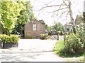
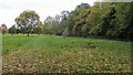
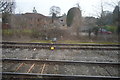
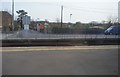
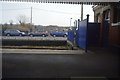
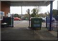
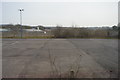
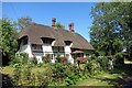
68 photos from this area
Area Information
Key information about the HP27 9NE including its size, population, and administrative classification.
- Area Type
- Postcode
- Area Size
- 14.4 hectares
- Population
- 2142
- Population Density
- 124 people/km²
House Prices in HP27 9NE
10
Properties
£601,286
Average Sold Price
£330,000
Lowest Price
£960,000
Highest Price
Showing 10 properties
| Address | Type | Beds | Baths | Last Sale Price | Last Sale Date | |
|---|---|---|---|---|---|---|
| Pippins, Horsenden Lane, Princes Risborough, HP27 9NE | Detached | 4 | 2 | £950,000 | Jul 2023 | |
| Orchard House, Horsenden Lane, Princes Risborough, HP27 9NE | house | 4 | - | £960,000 | Jan 2023 | |
| San Lingra, Horsenden Lane, Princes Risborough, HP27 9NE | house | - | - | £825,000 | Sep 2020 | |
| Larch Grove, Horsenden Lane, Princes Risborough, HP27 9NE | Bungalow | 3 | - | £330,000 | Nov 2010 | |
| Gate Cottage Barn, Horsenden Lane, Princes Risborough, HP27 9NE | Detached | - | - | £350,000 | Nov 2004 | |
| Kinder Lodge, Horsenden Lane, Princes Risborough, HP27 9NE | Detached | - | - | £409,000 | Apr 2003 | |
| Cornerways, Horsenden Lane, Princes Risborough, HP27 9NE | Detached | - | - | £385,000 | Dec 2001 | |
| Tennis 12M From Horsenden Lawn Tennis Club, Horsenden Lane 23M From Horsenden Lane, Horsenden Lane, Princes Risborough, HP27 9NE | Leisure | - | - | - | - | |
| The Grange, Horsenden Lane, Princes Risborough, HP27 9NE | Detached | - | - | - | - | |
| Byeways, Horsenden Lane, Princes Risborough, HP27 9NE | Detached | - | - | - | - |
Energy Efficiency in HP27 9NE
Amenities
Schools
| Rank | School | Type | Entry gender | Ages |
|---|
Explore more schools in this area
Go to Schools tabDemographics
Household Size
Two person
most common
Accommodation Type
Houses
most common
Tenure
80
majority
Ethnic Group
White
most common
Religion
N/A
most common
Household Composition
N/A
most common
Age
47
median
Adults (30-64 years)
most common
Household Deprivation
N/A
with no deprivation
NS-SEC
48
in Lower managerial occupations
Explore more demographic insights in this area
Go to Demographics tabPlanning
Planning Constraints
- Flood RiskPremium
- Ramsar Wetland SitesPremium
- Area of Outstanding Natural BeautyPremium
- Protected Nature ReservePremium
- Protected WoodlandPremium