Area Overview for HP27 0SX
Photos of HP27 0SX
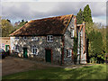
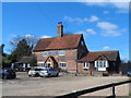
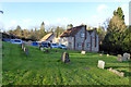
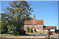
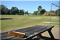
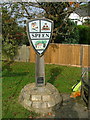
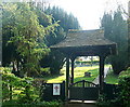
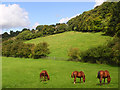
14 photos from this area
Area Information
Key information about the HP27 0SX including its size, population, and administrative classification.
- Area Type
- Postcode
- Area Size
- 22.0 hectares
- Population
- 1535
- Population Density
- 76 people/km²
House Prices in HP27 0SX
10
Properties
£485,825
Average Sold Price
£299,950
Lowest Price
£750,000
Highest Price
Showing 10 properties
| Address | Type | Beds | Baths | Last Sale Price | Last Sale Date | |
|---|---|---|---|---|---|---|
| Old King George, Flowers Bottom Lane, Speen, HP27 0SX | Detached | - | - | £750,000 | Feb 2021 | |
| Ashdown, Flowers Bottom Lane, Speen, HP27 0SX | house | - | - | £615,000 | Mar 2019 | |
| Finches, Flowers Bottom Lane, Speen, HP27 0SX | Detached | 3 | 1 | £460,000 | Dec 2009 | |
| Minns Cottage, Flowers Bottom Lane, Speen, HP27 0SX | house | 3 | - | £325,000 | Aug 2003 | |
| Hill Cottage, Flowers Bottom Lane, Speen, HP27 0SX | house | - | - | £465,000 | Aug 2002 | |
| The Old School House, Flowers Bottom Lane, Speen, HP27 0SX | Detached | - | - | £299,950 | Jul 1998 | |
| Fir View Cottage, Flowers Bottom Lane, Speen, HP27 0SX | Semi-detached | 4 | 3 | - | - | |
| Calyx, Flowers Bottom Lane, Speen, HP27 0SX | Bungalow | 2 | - | - | - | |
| Arcturus House, Flowers Bottom Lane, Speen, HP27 0SX | house | - | - | - | - | |
| George Farm, Flowers Bottom Lane, Speen, HP27 0SX | Detached | - | - | - | - |
Energy Efficiency in HP27 0SX
Amenities
Schools
| Rank | School | Type | Entry gender | Ages |
|---|
Explore more schools in this area
Go to Schools tabDemographics
Household Size
Two person
most common
Accommodation Type
Houses
most common
Tenure
64
majority
Ethnic Group
White
most common
Religion
N/A
most common
Household Composition
N/A
most common
Age
47
median
Adults (30-64 years)
most common
Household Deprivation
N/A
with no deprivation
NS-SEC
53
in Lower managerial occupations
Explore more demographic insights in this area
Go to Demographics tabPlanning
Planning Constraints
- Flood RiskPremium
- Ramsar Wetland SitesPremium
- Area of Outstanding Natural BeautyPremium
- Protected Nature ReservePremium
- Protected WoodlandPremium