Area Overview for HP27 0SA
Photos of HP27 0SA
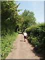
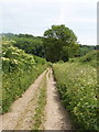
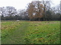
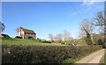
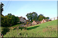
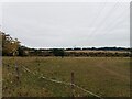


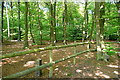
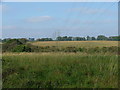

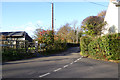
17 photos from this area
Area Information
Key information about the HP27 0SA including its size, population, and administrative classification.
- Area Type
- Postcode
- Area Size
- 5.5 hectares
- Population
- 1535
- Population Density
- 76 people/km²
House Prices in HP27 0SA
35
Properties
£737,618
Average Sold Price
£395,000
Lowest Price
£1,330,000
Highest Price
Showing 35 properties
| Address | Type | Beds | Baths | Last Sale Price | Last Sale Date | |
|---|---|---|---|---|---|---|
| Strawmoor, Studridge Lane, Speen, HP27 0SA | Detached | 4 | 2 | £845,000 | Apr 2024 | |
| Applegate Cottage, Studridge Lane, Speen, HP27 0SA | Detached | 3 | 2 | £765,000 | May 2023 | |
| Pots Cottage, Studridge Lane, Speen, HP27 0SA | Semi-detached | 3 | 2 | £550,000 | Feb 2023 | |
| Orchard Cottage, Studridge Lane, Speen, HP27 0SA | Detached | 2 | - | £535,000 | Mar 2022 | |
| Pyrus House, Studridge Lane, Speen, HP27 0SA | house | - | - | £1,330,000 | Apr 2021 | |
| Sefton House, Studridge Lane, Speen, HP27 0SA | house | - | - | £1,325,000 | Mar 2021 | |
| Holly Goblins, Studridge Lane, Speen, HP27 0SA | house | - | - | £638,000 | Feb 2021 | |
| Woodbine Cottage, Studridge Lane, Speen, HP27 0SA | house | - | - | £1,275,000 | Jan 2021 | |
| The Old Bakehouse, Studridge Lane, Speen, HP27 0SA | Detached | 4 | 1 | £930,000 | Sep 2020 | |
| Hedgerows, Studridge Lane, Speen, HP27 0SA | Bungalow | 3 | 2 | £540,000 | Sep 2020 |
Page 1 of 4
Energy Efficiency in HP27 0SA
Amenities
Schools
| Rank | School | Type | Entry gender | Ages |
|---|
Explore more schools in this area
Go to Schools tabDemographics
Household Size
Two person
most common
Accommodation Type
Houses
most common
Tenure
64
majority
Ethnic Group
White
most common
Religion
N/A
most common
Household Composition
N/A
most common
Age
47
median
Adults (30-64 years)
most common
Household Deprivation
N/A
with no deprivation
NS-SEC
53
in Lower managerial occupations
Explore more demographic insights in this area
Go to Demographics tabPlanning
Planning Constraints
- Flood RiskPremium
- Ramsar Wetland SitesPremium
- Area of Outstanding Natural BeautyPremium
- Protected Nature ReservePremium
- Protected WoodlandPremium