Area Overview for HP22 5TY
Photos of HP22 5TY
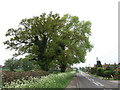
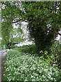
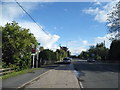
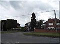
17 photos from this area
Area Information
Key information about the HP22 5TY including its size, population, and administrative classification.
- Area Type
- Postcode
- Area Size
- 8.9 hectares
- Population
- 2444
- Population Density
- 486 people/km²
House Prices in HP22 5TY
21
Properties
£354,714
Average Sold Price
£164,000
Lowest Price
£650,000
Highest Price
Showing 21 properties
| Address | Type | Beds | Baths | Last Sale Price | Last Sale Date | |
|---|---|---|---|---|---|---|
| 40 Ligo Avenue, Stoke Mandeville, HP22 5TY | Detached | 4 | 1 | £530,000 | Jan 2025 | |
| 34 Ligo Avenue, Stoke Mandeville, HP22 5TY | Detached | 3 | 1 | £365,000 | Sep 2020 | |
| 13 Ligo Avenue, Stoke Mandeville, HP22 5TY | Detached | 4 | 1 | £465,000 | Sep 2018 | |
| 37 Ligo Avenue, Stoke Mandeville, HP22 5TY | house | 4 | - | £650,000 | Oct 2016 | |
| 46 Ligo Avenue, Stoke Mandeville, HP22 5TY | Detached | 4 | 1 | £410,000 | Jun 2015 | |
| 23 Ligo Avenue, Stoke Mandeville, HP22 5TY | Detached | 4 | - | £405,000 | Mar 2015 | |
| 21 Ligo Avenue, Stoke Mandeville, HP22 5TY | house | - | - | £310,000 | Sep 2009 | |
| 19 Ligo Avenue, Stoke Mandeville, HP22 5TY | Detached | 4 | - | £386,000 | Aug 2008 | |
| 29 Ligo Avenue, Stoke Mandeville, HP22 5TY | Detached | - | - | £360,000 | Aug 2006 | |
| 38 Ligo Avenue, Stoke Mandeville, HP22 5TY | Detached | 4 | 2 | £290,000 | Aug 2006 |
Page 1 of 3
Energy Efficiency in HP22 5TY
Amenities
Schools
| Rank | School | Type | Entry gender | Ages |
|---|
Explore more schools in this area
Go to Schools tabDemographics
Household Size
Family (3-5 people)
most common
Accommodation Type
Houses
most common
Tenure
72
majority
Ethnic Group
White
most common
Religion
N/A
most common
Household Composition
N/A
most common
Age
47
median
Adults (30-64 years)
most common
Household Deprivation
N/A
with no deprivation
NS-SEC
44
in Lower managerial occupations
Explore more demographic insights in this area
Go to Demographics tabPlanning
Planning Constraints
- Flood RiskPremium
- Ramsar Wetland SitesPremium
- Area of Outstanding Natural BeautyPremium
- Protected Nature ReservePremium
- Protected WoodlandPremium