Area Overview for HP22 5QD
Photos of HP22 5QD
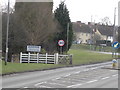
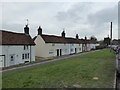
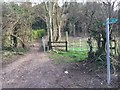
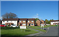
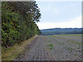
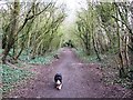
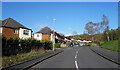
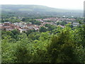
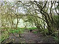
11 photos from this area
Area Information
Key information about the HP22 5QD including its size, population, and administrative classification.
- Area Type
- Postcode
- Area Size
- 1.6 hectares
- Population
- 1592
- Population Density
- 1771 people/km²
House Prices in HP22 5QD
21
Properties
£319,821
Average Sold Price
£156,500
Lowest Price
£478,000
Highest Price
Showing 21 properties
| Address | Type | Beds | Baths | Last Sale Price | Last Sale Date | |
|---|---|---|---|---|---|---|
| 5 Warneford Avenue, Wendover, HP22 5QD | Semi-detached | 4 | 1 | £435,000 | Mar 2024 | |
| 20 Warneford Avenue, Wendover, HP22 5QD | house | - | - | £415,000 | Jan 2023 | |
| 8 Warneford Avenue, Wendover, HP22 5QD | Terraced | 3 | 1 | £478,000 | Jun 2022 | |
| 13 Warneford Avenue, Wendover, HP22 5QD | Terraced | 3 | 1 | £310,000 | Jul 2020 | |
| 1 Warneford Avenue, Wendover, HP22 5QD | Terraced | 3 | 1 | £397,500 | Oct 2019 | |
| 6 Warneford Avenue, Wendover, HP22 5QD | house | 3 | - | £360,000 | Aug 2016 | |
| 15 Warneford Avenue, Wendover, HP22 5QD | Terraced | 3 | - | £390,000 | Apr 2016 | |
| 17 Warneford Avenue, Wendover, HP22 5QD | house | - | - | £385,000 | Mar 2016 | |
| 14 Warneford Avenue, Wendover, HP22 5QD | house | - | - | £385,000 | Jul 2015 | |
| 7 Warneford Avenue, Wendover, HP22 5QD | house | - | - | £335,000 | Feb 2015 |
Page 1 of 3
Energy Efficiency in HP22 5QD
Amenities
Schools
| Rank | School | Type | Entry gender | Ages |
|---|
Explore more schools in this area
Go to Schools tabDemographics
Household Size
One person
most common
Accommodation Type
Houses
most common
Tenure
59
majority
Ethnic Group
White
most common
Religion
N/A
most common
Household Composition
N/A
most common
Age
47
median
Adults (30-64 years)
most common
Household Deprivation
N/A
with no deprivation
NS-SEC
37
in Lower managerial occupations
Explore more demographic insights in this area
Go to Demographics tabPlanning
Planning Constraints
- Flood RiskPremium
- Ramsar Wetland SitesPremium
- Area of Outstanding Natural BeautyPremium
- Protected Nature ReservePremium
- Protected WoodlandPremium