Area Overview for HP22 5NB
Photos of HP22 5NB
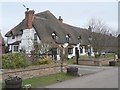
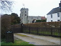
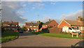
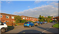
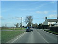
44 photos from this area
Area Information
Key information about the HP22 5NB including its size, population, and administrative classification.
- Area Type
- Postcode
- Area Size
- 6699 m²
- Population
- 1785
- Population Density
- 283 people/km²
House Prices in HP22 5NB
16
Properties
£255,276
Average Sold Price
£55,500
Lowest Price
£490,000
Highest Price
Showing 16 properties
| Address | Type | Beds | Baths | Last Sale Price | Last Sale Date | |
|---|---|---|---|---|---|---|
| 16 Overstrand, Aston Clinton, HP22 5NB | Semi-detached | 3 | 1 | £400,000 | Mar 2025 | |
| 24 Overstrand, Aston Clinton, HP22 5NB | Semi-detached | 3 | 1 | £410,000 | Jun 2024 | |
| 22 Overstrand, Aston Clinton, HP22 5NB | Retail | 4 | 1 | £490,000 | Oct 2022 | |
| 10 Overstrand, Aston Clinton, HP22 5NB | Semi-detached | 4 | 1 | £417,000 | Nov 2020 | |
| 12 Overstrand, Aston Clinton, HP22 5NB | Semi-detached | 3 | 1 | £325,000 | Sep 2015 | |
| 20 Overstrand, Aston Clinton, HP22 5NB | house | - | - | £250,000 | Mar 2012 | |
| 8 Overstrand, Aston Clinton, HP22 5NB | Semi-detached | - | - | £205,000 | May 2005 | |
| 6 Overstrand, Aston Clinton, HP22 5NB | Semi-detached | - | - | £151,309 | Jan 2004 | |
| 2 Overstrand, Aston Clinton, HP22 5NB | Semi-detached | - | - | £209,000 | Mar 2003 | |
| 14 Overstrand, Aston Clinton, HP22 5NB | Terraced | - | - | £88,500 | Jul 1997 |
Page 1 of 2
Energy Efficiency in HP22 5NB
Amenities
Schools
| Rank | School | Type | Entry gender | Ages |
|---|
Explore more schools in this area
Go to Schools tabDemographics
Household Size
Family (3-5 people)
most common
Accommodation Type
Houses
most common
Tenure
72
majority
Ethnic Group
White
most common
Religion
N/A
most common
Household Composition
N/A
most common
Age
47
median
Adults (30-64 years)
most common
Household Deprivation
N/A
with no deprivation
NS-SEC
41
in Lower managerial occupations
Explore more demographic insights in this area
Go to Demographics tabPlanning
Planning Constraints
- Flood RiskPremium
- Ramsar Wetland SitesPremium
- Area of Outstanding Natural BeautyPremium
- Protected Nature ReservePremium
- Protected WoodlandPremium