Area Overview for HP22 5AB
Photos of HP22 5AB
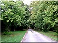
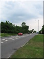
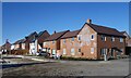
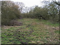
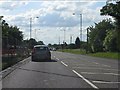
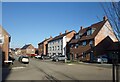
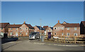
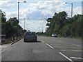
8 photos from this area
Area Information
Key information about the HP22 5AB including its size, population, and administrative classification.
- Area Type
- Postcode
- Area Size
- 84.1 hectares
- Population
- 1645
- Population Density
- 387 people/km²
House Prices in HP22 5AB
19
Properties
£377,250
Average Sold Price
£165,000
Lowest Price
£625,000
Highest Price
Showing 19 properties
| Address | Type | Beds | Baths | Last Sale Price | Last Sale Date | |
|---|---|---|---|---|---|---|
| The Old Dairy Farm, 125A Aston Clinton Road, Weston Turville, HP22 5AB | Bungalow | 3 | 2 | £625,000 | Nov 2024 | |
| 117 Aston Clinton Road, Weston Turville, HP22 5AB | Semi-detached | 3 | 3 | £515,000 | Mar 2024 | |
| 123 Aston Clinton Road, Weston Turville, HP22 5AB | Retail | 3 | 1 | £428,000 | Dec 2022 | |
| 109 Aston Clinton Road, Weston Turville, HP22 5AB | Semi-detached | 3 | 2 | £480,000 | Feb 2018 | |
| 107 Aston Clinton Road, Weston Turville, HP22 5AB | Semi-detached | 4 | 2 | £455,000 | Feb 2017 | |
| 125 Aston Clinton Road, Weston Turville, HP22 5AB | Semi-detached | 4 | - | £336,000 | Oct 2014 | |
| 43 Aston Clinton Road, Weston Turville, HP22 5AB | house | 2 | 1 | £220,000 | Jun 2009 | |
| 111 Aston Clinton Road, Weston Turville, HP22 5AB | Semi-detached | 2 | 2 | £371,000 | Jun 2004 | |
| 69 Aston Clinton Road, Weston Turville, HP22 5AB | Semi-detached | 3 | 1 | £177,500 | Nov 2001 | |
| 41 Aston Clinton Road, Weston Turville, HP22 5AB | Semi-detached | 3 | 3 | £165,000 | May 2000 |
Page 1 of 2
Energy Efficiency in HP22 5AB
Amenities
Schools
| Rank | School | Type | Entry gender | Ages |
|---|
Explore more schools in this area
Go to Schools tabDemographics
Household Size
Family (3-5 people)
most common
Accommodation Type
Houses
most common
Tenure
83
majority
Ethnic Group
White
most common
Religion
N/A
most common
Household Composition
N/A
most common
Age
47
median
Adults (30-64 years)
most common
Household Deprivation
N/A
with no deprivation
NS-SEC
50
in Lower managerial occupations
Explore more demographic insights in this area
Go to Demographics tabPlanning
Planning Constraints
- Flood RiskPremium
- Ramsar Wetland SitesPremium
- Area of Outstanding Natural BeautyPremium
- Protected Nature ReservePremium
- Protected WoodlandPremium