Area Overview for HP22 4PX
Photos of HP22 4PX
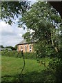
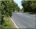
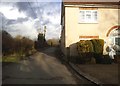
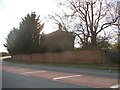
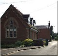
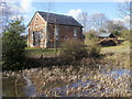
8 photos from this area
Area Information
Key information about the HP22 4PX including its size, population, and administrative classification.
- Area Type
- Postcode
- Area Size
- 34.5 hectares
- Population
- 1312
- Population Density
- 61 people/km²
House Prices in HP22 4PX
29
Properties
£504,682
Average Sold Price
£113,500
Lowest Price
£999,000
Highest Price
Showing 29 properties
| Address | Type | Beds | Baths | Last Sale Price | Last Sale Date | |
|---|---|---|---|---|---|---|
| 5 Nup End Lane, Wingrave, HP22 4PX | Terraced | 2 | 1 | £389,000 | Mar 2025 | |
| 7 Nup End Lane, Wingrave, HP22 4PX | house | - | - | £420,000 | Nov 2023 | |
| 17 Nup End Lane, Wingrave, HP22 4PX | Cottage | 4 | 2 | £810,000 | Oct 2023 | |
| 30 Nup End Lane, Wingrave, HP22 4PX | house | - | - | £330,000 | Feb 2021 | |
| 44 Nup End Lane, Wingrave, HP22 4PX | Detached | 4 | - | £620,000 | Dec 2018 | |
| 45 Nup End Lane, Wingrave, HP22 4PX | house | - | - | £999,000 | Mar 2018 | |
| 10 Nup End Lane, Wingrave, HP22 4PX | Terraced | 4 | 2 | £410,000 | Nov 2015 | |
| 43 Nup End Lane, Wingrave, HP22 4PX | Detached | 3 | 2 | £450,000 | Jan 2006 | |
| 27 Nup End Lane, Wingrave, HP22 4PX | house | - | - | £600,000 | Sep 2003 | |
| 50 Nup End Lane, Wingrave, HP22 4PX | Detached | - | - | £410,000 | Jul 2000 |
Page 1 of 3
Energy Efficiency in HP22 4PX
Amenities
Schools
| Rank | School | Type | Entry gender | Ages |
|---|
Explore more schools in this area
Go to Schools tabDemographics
Household Size
Two person
most common
Accommodation Type
Houses
most common
Tenure
71
majority
Ethnic Group
White
most common
Religion
N/A
most common
Household Composition
N/A
most common
Age
47
median
Adults (30-64 years)
most common
Household Deprivation
N/A
with no deprivation
NS-SEC
41
in Lower managerial occupations
Explore more demographic insights in this area
Go to Demographics tabPlanning
Planning Constraints
- Flood RiskPremium
- Ramsar Wetland SitesPremium
- Area of Outstanding Natural BeautyPremium
- Protected Nature ReservePremium
- Protected WoodlandPremium