Area Overview for HP22 4LG
Photos of HP22 4LG
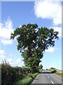
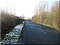
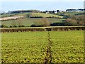
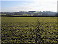
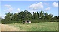
6 photos from this area
Area Information
Key information about the HP22 4LG including its size, population, and administrative classification.
- Area Type
- Postcode
- Area Size
- 4.0 km²
- Population
- 1523
- Population Density
- 83 people/km²
House Prices in HP22 4LG
35
Properties
£669,118
Average Sold Price
£200,000
Lowest Price
£1,625,000
Highest Price
Showing 35 properties
| Address | Type | Beds | Baths | Last Sale Price | Last Sale Date | |
|---|---|---|---|---|---|---|
| 4 Bushmead Road, Whitchurch, HP22 4LG | Bungalow | 4 | 2 | £700,000 | Nov 2025 | |
| 10 Bushmead Road, Whitchurch, HP22 4LG | house | 6 | 2 | £1,625,000 | May 2024 | |
| 32 Bushmead Road, Whitchurch, HP22 4LG | house | 5 | 2 | £1,060,000 | Sep 2023 | |
| 12 Bushmead Road, Whitchurch, HP22 4LG | house | - | - | £1,165,000 | Aug 2021 | |
| 8 Bushmead Road, Whitchurch, HP22 4LG | house | - | - | £355,000 | Jun 2021 | |
| 2 Bushmead Road, Whitchurch, HP22 4LG | Detached | 3 | - | £670,000 | Jun 2021 | |
| Orchard Barn, Bushmead Road, Whitchurch, HP22 4LG | Bungalow | 3 | 3 | £665,000 | Feb 2021 | |
| 29 Bushmead Road, Whitchurch, HP22 4LG | Semi-detached | 3 | 2 | £285,000 | Mar 2020 | |
| 20 Bushmead Road, Whitchurch, HP22 4LG | Bungalow | 3 | 1 | £540,000 | Oct 2019 | |
| 1 Bushmead Road, Whitchurch, HP22 4LG | Semi-detached | 3 | 2 | £298,000 | Jul 2019 |
Page 1 of 4
Energy Efficiency in HP22 4LG
Amenities
Schools
| Rank | School | Type | Entry gender | Ages |
|---|
Explore more schools in this area
Go to Schools tabDemographics
Household Size
Two person
most common
Accommodation Type
Houses
most common
Tenure
80
majority
Ethnic Group
White
most common
Religion
N/A
most common
Household Composition
N/A
most common
Age
47
median
Adults (30-64 years)
most common
Household Deprivation
N/A
with no deprivation
NS-SEC
50
in Lower managerial occupations
Explore more demographic insights in this area
Go to Demographics tabPlanning
Planning Constraints
- Flood RiskPremium
- Ramsar Wetland SitesPremium
- Area of Outstanding Natural BeautyPremium
- Protected Nature ReservePremium
- Protected WoodlandPremium