Area Overview for HP22 4JT
Photos of HP22 4JT
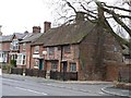
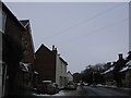
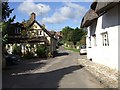
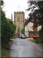
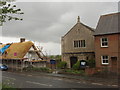
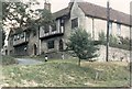
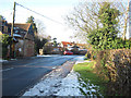
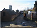
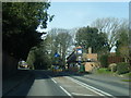
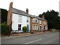
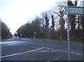
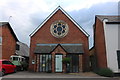
43 photos from this area
Area Information
Key information about the HP22 4JT including its size, population, and administrative classification.
- Area Type
- Postcode
- Area Size
- 1.0 hectares
- Population
- 1523
- Population Density
- 83 people/km²
House Prices in HP22 4JT
15
Properties
£310,500
Average Sold Price
£35,000
Lowest Price
£465,000
Highest Price
Showing 15 properties
| Address | Type | Beds | Baths | Last Sale Price | Last Sale Date | |
|---|---|---|---|---|---|---|
| 40 High Street, Whitchurch, HP22 4JT | house | - | - | £294,000 | May 2012 | |
| 24 High Street, Whitchurch, HP22 4JT | house | 5 | - | £448,000 | Dec 2010 | |
| 22 High Street, Whitchurch, HP22 4JT | house | - | - | £35,000 | Mar 2000 | |
| Mary Monks House, 12 High Street, Whitchurch, HP22 4JT | Detached | 6 | 4 | £465,000 | Apr 1997 | |
| 42B High Street, Whitchurch, HP22 4JT | Maisonette | 2 | 1 | - | - | |
| 42A High Street, Whitchurch, HP22 4JT | Flat | 1 | 1 | - | - | |
| Beechmoor House, 26 High Street, Whitchurch, HP22 4JT | Detached | - | - | - | - | |
| The White Swan Ph, 10 High Street, Whitchurch, HP22 4JT | restaurant_cafe | - | - | - | - | |
| 28 High Street, Whitchurch, HP22 4JT | Terraced | - | - | - | - | |
| 36 High Street, Whitchurch, HP22 4JT | house | - | - | - | - |
Page 1 of 2
Energy Efficiency in HP22 4JT
Amenities
Schools
| Rank | School | Type | Entry gender | Ages |
|---|
Explore more schools in this area
Go to Schools tabDemographics
Household Size
Two person
most common
Accommodation Type
Houses
most common
Tenure
80
majority
Ethnic Group
White
most common
Religion
N/A
most common
Household Composition
N/A
most common
Age
47
median
Adults (30-64 years)
most common
Household Deprivation
N/A
with no deprivation
NS-SEC
50
in Lower managerial occupations
Explore more demographic insights in this area
Go to Demographics tabPlanning
Planning Constraints
- Flood RiskPremium
- Ramsar Wetland SitesPremium
- Area of Outstanding Natural BeautyPremium
- Protected Nature ReservePremium
- Protected WoodlandPremium