Area Overview for HP22 4HT
Photos of HP22 4HT
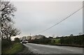
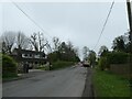

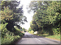


18 photos from this area
Area Information
Key information about the HP22 4HT including its size, population, and administrative classification.
- Area Type
- Postcode
- Area Size
- 2.4 km²
- Population
- 1302
- Population Density
- 63 people/km²
House Prices in HP22 4HT
24
Properties
£857,375
Average Sold Price
£162,000
Lowest Price
£1,600,000
Highest Price
Showing 24 properties
| Address | Type | Beds | Baths | Last Sale Price | Last Sale Date | |
|---|---|---|---|---|---|---|
| Church Close Cottage, Pitchcott Hill, Pitchcott, HP22 4HT | Semi-detached | 5 | 3 | £720,000 | Nov 2022 | |
| The Old Byre, Pitchcott Hill, Pitchcott, HP22 4HT | house | - | - | £1,600,000 | Sep 2022 | |
| The Gate House, Pitchcott Hill, Pitchcott, HP22 4HT | house | 5 | - | £860,000 | Mar 2022 | |
| The Old Rectory, Pitchcott Hill, Pitchcott, HP22 4HT | Detached | 5 | 2 | £1,435,000 | Aug 2019 | |
| Penpont, Pitchcott Hill, Pitchcott, HP22 4HT | house | - | - | £595,000 | Aug 2016 | |
| Barnhill View, Pitchcott Hill, Pitchcott, HP22 4HT | Detached | 4 | - | £499,999 | May 2014 | |
| Belleview, Pitchcott Hill, Pitchcott, HP22 4HT | house | - | - | £987,000 | Oct 2012 | |
| Galleons Lap, Pitchcott Hill, Pitchcott, HP22 4HT | house | - | - | £162,000 | Nov 1998 | |
| Kirkdene, Pitchcott Hill, Pitchcott, HP22 4HT | Detached | 5 | 5 | - | - | |
| Manor Farm Barn, Pitchcott Hill, Pitchcott, HP22 4HT | Land | - | - | - | - |
Page 1 of 3
Energy Efficiency in HP22 4HT
Amenities
Schools
| Rank | School | Type | Entry gender | Ages |
|---|
Explore more schools in this area
Go to Schools tabDemographics
Household Size
Two person
most common
Accommodation Type
Houses
most common
Tenure
86
majority
Ethnic Group
White
most common
Religion
N/A
most common
Household Composition
N/A
most common
Age
47
median
Adults (30-64 years)
most common
Household Deprivation
N/A
with no deprivation
NS-SEC
49
in Lower managerial occupations
Explore more demographic insights in this area
Go to Demographics tabPlanning
Planning Constraints
- Flood RiskPremium
- Ramsar Wetland SitesPremium
- Area of Outstanding Natural BeautyPremium
- Protected Nature ReservePremium
- Protected WoodlandPremium