Area Overview for HP21 9DR
Photos of HP21 9DR


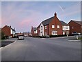
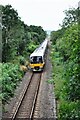
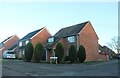
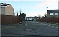
31 photos from this area
Area Information
Key information about the HP21 9DR including its size, population, and administrative classification.
- Area Type
- Postcode
- Area Size
- 3.5 hectares
- Population
- 2444
- Population Density
- 486 people/km²
House Prices in HP21 9DR
6
Properties
£498,500
Average Sold Price
£447,000
Lowest Price
£550,000
Highest Price
Showing 6 properties
| Address | Type | Beds | Baths | Last Sale Price | Last Sale Date | |
|---|---|---|---|---|---|---|
| 145 Lower Road, Stoke Mandeville, HP21 9DR | Detached | 3 | 1 | £447,000 | Apr 2021 | |
| 143 Lower Road, Stoke Mandeville, HP21 9DR | Detached | 4 | 3 | £550,000 | Oct 2016 | |
| Lawrence Lodge, 147 Lower Road, Stoke Mandeville, HP21 9DR | Bungalow | 3 | 1 | - | - | |
| Wenlock House, 149-151 Lower Road, Stoke Mandeville, HP21 9DR | hospital_care_home | 3 | - | - | - | |
| Red House Farm, Lower Road, Stoke Mandeville, HP21 9DR | Detached | 4 | 2 | - | - | |
| 151 Lower Road, Stoke Mandeville, HP21 9DR | Detached | - | - | - | - |
Energy Efficiency in HP21 9DR
Amenities
Schools
| Rank | School | Type | Entry gender | Ages |
|---|
Explore more schools in this area
Go to Schools tabDemographics
Household Size
Family (3-5 people)
most common
Accommodation Type
Houses
most common
Tenure
72
majority
Ethnic Group
White
most common
Religion
N/A
most common
Household Composition
N/A
most common
Age
47
median
Adults (30-64 years)
most common
Household Deprivation
N/A
with no deprivation
NS-SEC
44
in Lower managerial occupations
Explore more demographic insights in this area
Go to Demographics tabPlanning
Planning Constraints
- Flood RiskPremium
- Ramsar Wetland SitesPremium
- Area of Outstanding Natural BeautyPremium
- Protected Nature ReservePremium
- Protected WoodlandPremium