Area Overview for HP21 7JJ
Photos of HP21 7JJ
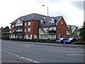
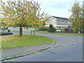
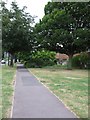
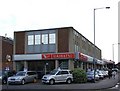
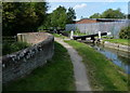
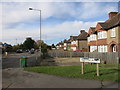
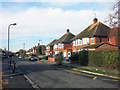
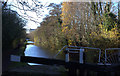
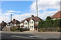
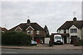

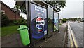
32 photos from this area
Area Information
Key information about the HP21 7JJ including its size, population, and administrative classification.
- Area Type
- Postcode
- Area Size
- 1.5 hectares
- Population
- 1260
- Population Density
- 2204 people/km²
House Prices in HP21 7JJ
39
Properties
£268,013
Average Sold Price
£51,000
Lowest Price
£525,000
Highest Price
Showing 39 properties
| Address | Type | Beds | Baths | Last Sale Price | Last Sale Date | |
|---|---|---|---|---|---|---|
| 17 Walton Way, Aylesbury, HP21 7JJ | Terraced | 3 | 1 | £388,000 | Jul 2025 | |
| 57A Walton Way, Aylesbury, HP21 7JJ | Semi-detached | 4 | 1 | £525,000 | Jun 2024 | |
| 37 Walton Way, Aylesbury, HP21 7JJ | Retail | 3 | 1 | £428,000 | Aug 2022 | |
| 39 Walton Way, Aylesbury, HP21 7JJ | Semi-detached | 3 | 1 | £420,000 | Apr 2022 | |
| 67 Walton Way, Aylesbury, HP21 7JJ | Semi-detached | 3 | 2 | £385,000 | May 2021 | |
| 69 Walton Way, Aylesbury, HP21 7JJ | Semi-detached | 3 | 1 | £363,000 | Sep 2020 | |
| 41 Walton Way, Aylesbury, HP21 7JJ | Semi-detached | 3 | 1 | £367,000 | Nov 2019 | |
| 47 Walton Way, Aylesbury, HP21 7JJ | Semi-detached | 3 | 1 | £340,000 | Aug 2019 | |
| 19 Walton Way, Aylesbury, HP21 7JJ | Terraced | 3 | - | £326,000 | Sep 2018 | |
| 49 Walton Way, Aylesbury, HP21 7JJ | Semi-detached | 3 | 1 | £339,000 | Aug 2018 |
Page 1 of 4
Energy Efficiency in HP21 7JJ
Amenities
Schools
| Rank | School | Type | Entry gender | Ages |
|---|
Explore more schools in this area
Go to Schools tabDemographics
Household Size
Family (3-5 people)
most common
Accommodation Type
Houses
most common
Tenure
81
majority
Ethnic Group
White
most common
Religion
N/A
most common
Household Composition
N/A
most common
Age
47
median
Adults (30-64 years)
most common
Household Deprivation
N/A
with no deprivation
NS-SEC
42
in Lower managerial occupations
Explore more demographic insights in this area
Go to Demographics tabPlanning
Planning Constraints
- Flood RiskPremium
- Ramsar Wetland SitesPremium
- Area of Outstanding Natural BeautyPremium
- Protected Nature ReservePremium
- Protected WoodlandPremium