Area Overview for HP19 8BB
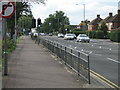
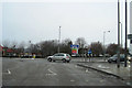
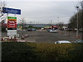
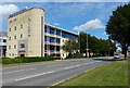
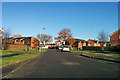
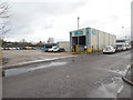
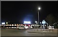
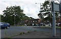
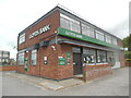
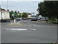
Photos of HP19 8BB


Area Information
HP19 8BB is a compact residential postcode in England, spanning just 1.7 hectares and home to 1,602 residents. Its high population density—94,424 people per square kilometre—reflects a tightly knit community, though the area’s small size means it is best suited for those prioritising proximity to local amenities over expansive living space. The postcode falls within a cluster of homes, with a focus on single-family dwellings. Daily life here is shaped by its connectivity to nearby towns and services, with rail links to Aylesbury and surrounding areas providing access to broader opportunities. The area’s digital infrastructure is robust, with a broadband score of 98, ensuring reliable internet for both work and leisure. However, its mobile coverage, while good at 83, may not meet the needs of those relying heavily on data-heavy usage. For buyers seeking a quiet, well-serviced neighbourhood with practical access to retail and transport, HP19 8BB offers a blend of convenience and simplicity.
- Area Type
- Postcode
- Area Size
- 1.7 hectares
- Population
- 1602
- Population Density
- 2879 people/km²
The property market in HP19 8BB is defined by its focus on houses, with 50% of residents owning their homes. This suggests a mix of owner-occupied properties and rental units, though the absence of flats implies a preference for single-family dwellings. Given the area’s small size, the housing stock is likely limited, with buyers needing to consider nearby postcode areas for more options. The predominance of houses may appeal to families or individuals seeking more space, but the compact nature of HP19 8BB means properties are unlikely to be large. For buyers, this small area’s market is likely to be competitive, with limited inventory. Those interested in this postcode should also evaluate the surrounding regions, as the immediate vicinity may offer additional choices. The balance between home ownership and rentals suggests a stable but not overly dynamic market.
House Prices in HP19 8BB
No properties found in this postcode.
Energy Efficiency in HP19 8BB
Living in HP19 8BB grants access to a range of local amenities within practical reach. Retail options include Tesco Aylesbury, Aldi Quarrendon, and Co-op Fairford, ensuring daily shopping needs are met without lengthy trips. The area’s rail network, with stations such as Aylesbury Railway Station and Aylesbury Vale Parkway, connects residents to nearby towns and services, enhancing convenience for both leisure and work. While the data does not specify parks or leisure facilities, the proximity to Aylesbury—a town with cultural and recreational offerings—suggests opportunities for dining, shopping, and community events. The compact nature of HP19 8BB means residents can access essentials quickly, though larger facilities may require venturing slightly further. This balance of local convenience and regional connectivity shapes a lifestyle that prioritises practicality and accessibility.
Amenities
Schools
| Rank | School | Type | Entry gender | Ages |
|---|
Explore more schools in this area
Go to Schools tabDemographics
The population of HP19 8BB is predominantly composed of adults aged 30–64, with a median age of 47. This suggests a mature, stable community where many residents are likely in their prime working or retirement years. Home ownership sits at 50%, indicating a mix of owner-occupied properties and rental units, though the accommodation type is almost entirely houses, not flats. The predominant ethnic group is White, reflecting a homogenous demographic profile. The high population density—nearly 94,424 people per square kilometre—raises questions about the balance between residential space and shared amenities. While the data does not specify deprivation levels, the concentration of households in a small area may mean limited private outdoor space per resident. This density could influence the character of the neighbourhood, fostering a close-knit environment but potentially limiting opportunities for expansion or new developments.
Household Size
Accommodation Type
Tenure
Ethnic Group
Religion
Household Composition
Age
Household Deprivation
NS-SEC
Explore more demographic insights in this area
Go to Demographics tabPlanning
Planning Constraints
- Flood RiskPremium
- Ramsar Wetland SitesPremium
- Area of Outstanding Natural BeautyPremium
- Protected Nature ReservePremium
- Protected WoodlandPremium