Area Overview for HP18 0ZA
Photos of HP18 0ZA
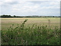
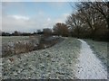


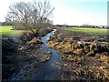
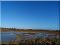
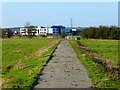
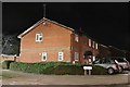
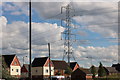
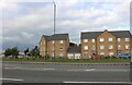

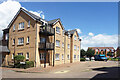
37 photos from this area
Area Information
Key information about the HP18 0ZA including its size, population, and administrative classification.
- Area Type
- Postcode
- Area Size
- 7232 m²
- Population
- 1449
- Population Density
- 1364 people/km²
House Prices in HP18 0ZA
34
Properties
£289,572
Average Sold Price
£150,000
Lowest Price
£535,000
Highest Price
Showing 34 properties
| Address | Type | Beds | Baths | Last Sale Price | Last Sale Date | |
|---|---|---|---|---|---|---|
| 6 Carrick Street, Aylesbury, HP18 0ZA | house | 3 | 2 | £400,000 | Jun 2025 | |
| 2 Carrick Street, Aylesbury, HP18 0ZA | Semi-detached | 3 | 1 | £190,000 | Oct 2024 | |
| 27 Carrick Street, Aylesbury, HP18 0ZA | Semi-detached | 3 | 1 | £150,000 | Mar 2023 | |
| Dunton Abbey, 20 Carrick Street, Aylesbury, HP18 0ZA | Retail | 3 | 2 | £397,000 | Sep 2022 | |
| 29 Carrick Street, Aylesbury, HP18 0ZA | Retail | 4 | 2 | £535,000 | Jun 2022 | |
| 32 Carrick Street, Aylesbury, HP18 0ZA | Flat | 2 | 1 | £230,000 | Apr 2022 | |
| 4 Carrick Street, Aylesbury, HP18 0ZA | house | - | - | £172,500 | Jan 2022 | |
| 22 Carrick Street, Aylesbury, HP18 0ZA | house | - | - | £360,000 | Nov 2021 | |
| 38 Carrick Street, Aylesbury, HP18 0ZA | Flat | - | - | £192,000 | May 2021 | |
| 1 Carrick Street, Aylesbury, HP18 0ZA | house | - | - | £325,000 | Mar 2021 |
Page 1 of 4
Energy Efficiency in HP18 0ZA
Amenities
Schools
| Rank | School | Type | Entry gender | Ages |
|---|
Explore more schools in this area
Go to Schools tabDemographics
Household Size
Two person
most common
Accommodation Type
Houses
most common
Tenure
82
majority
Ethnic Group
White
most common
Religion
N/A
most common
Household Composition
N/A
most common
Age
47
median
Adults (30-64 years)
most common
Household Deprivation
N/A
with no deprivation
NS-SEC
40
in Lower managerial occupations
Explore more demographic insights in this area
Go to Demographics tabPlanning
Planning Constraints
- Flood RiskPremium
- Ramsar Wetland SitesPremium
- Area of Outstanding Natural BeautyPremium
- Protected Nature ReservePremium
- Protected WoodlandPremium