Area Overview for HP18 0QU
Photos of HP18 0QU
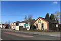
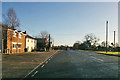
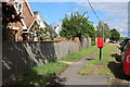
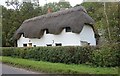
15 photos from this area
Area Information
Key information about the HP18 0QU including its size, population, and administrative classification.
- Area Type
- Postcode
- Area Size
- 18.3 hectares
- Population
- 1795
- Population Density
- 55 people/km²
House Prices in HP18 0QU
10
Properties
£508,667
Average Sold Price
£365,000
Lowest Price
£760,000
Highest Price
Showing 10 properties
| Address | Type | Beds | Baths | Last Sale Price | Last Sale Date | |
|---|---|---|---|---|---|---|
| Resty Nook, Grendon Road, Grendon Underwood, HP18 0QU | Detached | 3 | 1 | £401,000 | Jul 2025 | |
| Terrys Dairy, Grendon Road, Grendon Underwood, HP18 0QU | Retail | 4 | 2 | £760,000 | Apr 2022 | |
| Foxden Cottage, 1 Grendon Road, Grendon Underwood, HP18 0QU | house | 3 | - | £365,000 | Aug 2021 | |
| Wisteria Lodge, Bicester Road, Woodham, HP18 0QU | Detached | 4 | 2 | - | - | |
| 2 Grendon Road, Grendon Underwood, HP18 0QU | Semi-detached | 4 | 1 | - | - | |
| Primrose Cottage, Grendon Road, Grendon Underwood, HP18 0QU | Cottage | 3 | 1 | - | - | |
| The White House, Grendon Road, Grendon Underwood, HP18 0QU | Detached | - | - | - | - | |
| Kings Oak, Grendon Road, Grendon Underwood, HP18 0QU | Detached | - | - | - | - | |
| Brick Kiln Farm, Grendon Road, Grendon Underwood, HP18 0QU | Detached | - | - | - | - | |
| Margarets Lodge, Grendon Road, Grendon Underwood, HP18 0QU | Bungalow | - | - | - | - |
Energy Efficiency in HP18 0QU
Amenities
Schools
| Rank | School | Type | Entry gender | Ages |
|---|
Explore more schools in this area
Go to Schools tabDemographics
Household Size
Family (3-5 people)
most common
Accommodation Type
Houses
most common
Tenure
85
majority
Ethnic Group
White
most common
Religion
N/A
most common
Household Composition
N/A
most common
Age
47
median
Adults (30-64 years)
most common
Household Deprivation
N/A
with no deprivation
NS-SEC
32
in Lower managerial occupations
Explore more demographic insights in this area
Go to Demographics tabPlanning
Planning Constraints
- Flood RiskPremium
- Ramsar Wetland SitesPremium
- Area of Outstanding Natural BeautyPremium
- Protected Nature ReservePremium
- Protected WoodlandPremium