Area Overview for HP18 0PL
Photos of HP18 0PL
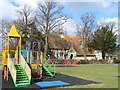
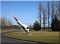
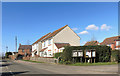

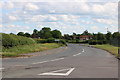
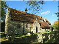
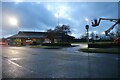
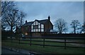
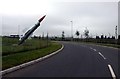

17 photos from this area
Area Information
Key information about the HP18 0PL including its size, population, and administrative classification.
- Area Type
- Postcode
- Area Size
- 8.4 hectares
- Population
- 1795
- Population Density
- 55 people/km²
House Prices in HP18 0PL
26
Properties
£333,234
Average Sold Price
£65,000
Lowest Price
£1,150,000
Highest Price
Showing 26 properties
| Address | Type | Beds | Baths | Last Sale Price | Last Sale Date | |
|---|---|---|---|---|---|---|
| 2A Burnham Road, Westcott, HP18 0PL | house | - | - | £625,000 | Jun 2025 | |
| 7 Burnham Road, Westcott, HP18 0PL | house | - | - | £495,000 | Sep 2022 | |
| Church Farm House, Burnham Road, Westcott, HP18 0PL | Detached | 4 | - | £1,150,000 | Dec 2017 | |
| 19 Burnham Road, Westcott, HP18 0PL | Semi-detached | 3 | - | £295,000 | Oct 2016 | |
| 9 Burnham Road, Westcott, HP18 0PL | Semi-detached | 4 | - | £380,000 | Jul 2013 | |
| 5 Burnham Road, Westcott, HP18 0PL | house | - | - | £247,000 | Apr 2011 | |
| 1A Burnham Road, Westcott, HP18 0PL | house | - | - | £325,000 | Dec 2010 | |
| 27 Burnham Road, Westcott, HP18 0PL | house | - | - | £485,000 | Jul 2009 | |
| 29 Burnham Road, Westcott, HP18 0PL | Detached | 5 | 2 | £490,000 | Apr 2009 | |
| 1 Burnham Road, Westcott, HP18 0PL | house | 4 | - | £381,000 | Nov 2007 |
Page 1 of 3
Energy Efficiency in HP18 0PL
Amenities
Schools
| Rank | School | Type | Entry gender | Ages |
|---|
Explore more schools in this area
Go to Schools tabDemographics
Household Size
Family (3-5 people)
most common
Accommodation Type
Houses
most common
Tenure
85
majority
Ethnic Group
White
most common
Religion
N/A
most common
Household Composition
N/A
most common
Age
47
median
Adults (30-64 years)
most common
Household Deprivation
N/A
with no deprivation
NS-SEC
32
in Lower managerial occupations
Explore more demographic insights in this area
Go to Demographics tabPlanning
Planning Constraints
- Flood RiskPremium
- Ramsar Wetland SitesPremium
- Area of Outstanding Natural BeautyPremium
- Protected Nature ReservePremium
- Protected WoodlandPremium