Area Overview for HP18 0NQ
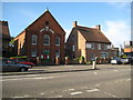
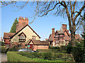
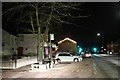
Photos of HP18 0NQ


Area Information
Living in HP18 0NQ means being part of a small, tightly knit residential cluster in England. The area covers 2120 square metres and is home to 1243 people, giving it a population density of 518 people per square kilometre. This compact postcode is typical of rural or semi-rural settings, where homes are spaced apart but still within reach of local amenities. The community here is predominantly composed of adults aged 30 to 64, with a median age of 47, suggesting a stable, mature demographic. Daily life is shaped by proximity to nearby towns, with rail stations and retail hubs within practical reach. While the area is small, it offers a balance between residential tranquillity and access to essential services. The lack of major environmental constraints, such as protected woodlands or AONBs, means development is not restricted, though the low flood risk and below-average crime rates add to its appeal. For those seeking a quiet, low-maintenance lifestyle with a strong sense of local identity, HP18 0NQ provides a foundation.
- Area Type
- Postcode
- Area Size
- 2120 m²
- Population
- 1243
- Population Density
- 518 people/km²
The property market in HP18 0NQ is characterised by high home ownership, with 65% of properties occupied by their owners. This suggests a stable, long-term resident base rather than a rental-heavy market. The accommodation type is predominantly houses, which are likely family homes given the area’s demographic profile. As a small postcode area, the housing stock is limited, meaning properties may be in high demand. Buyers should consider the proximity to nearby towns, as the immediate surroundings may offer additional options. The absence of planning constraints, such as protected woodlands or AONBs, means development is not restricted, though the area’s size limits expansion. For those seeking a home in a quiet, low-density setting with a focus on owner-occupation, HP18 0NQ presents a niche opportunity.
House Prices in HP18 0NQ
No properties found in this postcode.
Energy Efficiency in HP18 0NQ
Residents of HP18 0NQ benefit from nearby retail amenities, including Sainsburys Aylesbury, Tesco Aylesbury, and M&S Aylesbury, which are all within practical reach. These shops provide everyday convenience, from groceries to clothing, reducing the need for long journeys. The area’s rail stations also connect to broader networks, enabling access to larger towns for dining, entertainment, or leisure. While the data does not specify parks or recreational facilities, the absence of protected natural areas suggests open spaces may be limited. The combination of local retail and transport links creates a lifestyle that balances self-sufficiency with the ability to engage with nearby hubs. For those valuing proximity to shops and reliable transport, HP18 0NQ offers a practical, if modest, array of amenities.
Amenities
Schools
Residents of HP18 0NQ have access to several schools, including Waddesdon Village Primary School, which holds a ‘good’ Ofsted rating, and Waddesdon Church of England School, an academy with an ‘outstanding’ rating. The presence of both state and academy schools provides families with options, though no secondary schools are listed in the data. The ‘outstanding’ rating at the Church of England School suggests high educational standards, which may be a draw for families prioritising academic performance. The mix of school types reflects a blend of traditional and specialist education, though the absence of data on pupil numbers or catchment areas means potential buyers should verify suitability for their needs. Overall, the area’s schools cater to primary education, with proximity to nearby towns offering additional resources.
| Rank | School | Type | Entry gender | Ages |
|---|
Explore more schools in this area
Go to Schools tabDemographics
The population of HP18 0NQ is 1243, with a median age of 47. This indicates a community skewed towards adults, particularly those aged 30 to 64, who make up the most common age range. Home ownership is high at 65%, suggesting a strong presence of long-term residents and a stable housing market. The accommodation type is predominantly houses, which aligns with the area’s residential character. The predominant ethnic group is White, though no specific data on diversity or deprivation is provided. The age profile implies a community focused on family life, with fewer young children or elderly residents compared to other areas. This demographic structure may influence local services, such as schools and healthcare, which are tailored to adult needs. The low population density of 518 people per square kilometre further reinforces the area’s semi-rural, low-traffic environment.
Household Size
Accommodation Type
Tenure
Ethnic Group
Religion
Household Composition
Age
Household Deprivation
NS-SEC
Explore more demographic insights in this area
Go to Demographics tabPlanning
Planning Constraints
- Flood RiskPremium
- Ramsar Wetland SitesPremium
- Area of Outstanding Natural BeautyPremium
- Protected Nature ReservePremium
- Protected WoodlandPremium