Area Overview for HP17 9RT
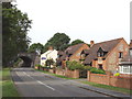
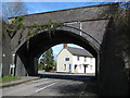
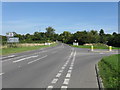
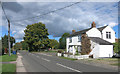
Photos of HP17 9RT


Area Information
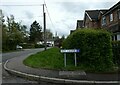
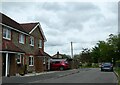
Living in HP17 9RT offers a quiet, residential lifestyle in a small cluster of homes. With a population of 2142 spread over 17 km², the area maintains a low density of 124 people per square kilometre, fostering a close-knit community feel. The demographic profile suggests a mature population, with a median age of 47 and most residents falling between 30 and 64 years old. This age range indicates a stable, family-oriented environment, with 80% of homes owned outright rather than rented. The area is characterised by its traditional housing stock, with most properties being detached or semi-detached homes. Proximity to rail stations and local shops makes daily life convenient, while the absence of major environmental constraints ensures a straightforward planning landscape. For those seeking a peaceful, low-density neighbourhood with practical amenities, HP17 9RT provides a balanced blend of residential comfort and accessibility.
- Area Type
- Postcode
- Area Size
- Not available
- Population
- 2142
- Population Density
- 124 people/km²
The property market in HP17 9RT is dominated by owner-occupied homes, with 80% of properties owned outright. This high rate of home ownership points to a community that values long-term investment and stability. The accommodation type is primarily houses, which are more common than flats or apartments in this area. This suggests a traditional, low-density housing stock that caters to families and individuals seeking space and privacy. The small size of the area means the housing stock is limited, making it a niche market for buyers. However, the proximity to rail stations and local amenities enhances the appeal of properties here. For buyers, this means a focus on established homes with potential for long-term value, though the market is unlikely to offer a wide range of options. The owner-occupied nature of the area also implies lower rental demand, which could influence future property value trends.
House Prices in HP17 9RT
No properties found in this postcode.
Energy Efficiency in HP17 9RT
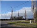
Residents of HP17 9RT have access to a range of nearby amenities that support daily life. Retail options include Waitrose Little Waitrose, Tesco Princes, and Co-op Princes, offering a mix of grocery and convenience shopping. These stores provide essential services, reducing the need for long trips to larger towns. The area’s rail stations—Monks Risborough, Princes Risborough, and Little Kimble—connect residents to broader transport networks, facilitating travel for work, leisure, or social purposes. While the data does not mention parks or leisure facilities, the presence of multiple retail and transport hubs suggests a practical, community-focused lifestyle. The combination of local shopping and accessible rail links ensures that daily errands and commuting are efficient, contributing to a convenient and self-sufficient living experience.
Amenities
Schools
The nearest schools to HP17 9RT include Longwick Church of England Combined School, which operates as both a primary school and an academy with an Ofsted rating of 'good'. This dual designation provides families with a single institution that covers early years and primary education, reducing the need for multiple school transitions. The 'good' rating indicates a school that meets national standards in teaching quality and student outcomes. For families prioritising educational consistency, this school offers a reliable option. The absence of other listed schools in the data suggests that this is the primary educational hub for the area. Parents should consider the school’s proximity to their homes, as well as its academic performance, when evaluating the area’s suitability for their children’s needs.
| Rank | School | Type | Entry gender | Ages |
|---|
Explore more schools in this area
Go to Schools tabDemographics
The community in HP17 9RT is predominantly composed of adults aged 30 to 64, with a median age of 47. This suggests a mature, settled population, likely with strong ties to the local area. Home ownership is high, with 80% of residents owning their homes, indicating a stable housing market. The accommodation type is primarily houses, reflecting a traditional, low-density residential pattern. The predominant ethnic group is White, which aligns with broader regional trends. The age profile and ownership rates suggest a community focused on long-term residency rather than transient living. With no specific data on deprivation, the area appears to support a quality of life that prioritises stability and self-ownership. This demographic profile positions HP17 9RT as a place where families and professionals can establish roots without the pressures of high turnover or rental dependency.
Household Size
Accommodation Type
Tenure
Ethnic Group
Religion
Household Composition
Age
Household Deprivation
NS-SEC
Explore more demographic insights in this area
Go to Demographics tabPlanning
Planning Constraints
- Flood RiskPremium
- Ramsar Wetland SitesPremium
- Area of Outstanding Natural BeautyPremium
- Protected Nature ReservePremium
- Protected WoodlandPremium