Area Overview for HP17 8TW
Photos of HP17 8TW
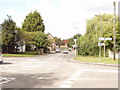
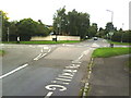
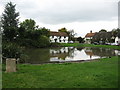
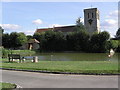
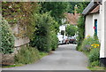
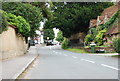
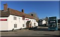
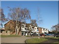
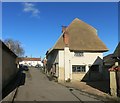
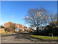
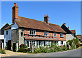
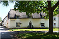
70 photos from this area
Area Information
Key information about the HP17 8TW including its size, population, and administrative classification.
- Area Type
- Postcode
- Area Size
- 8906 m²
- Population
- 1219
- Population Density
- 1042 people/km²
House Prices in HP17 8TW
12
Properties
£561,632
Average Sold Price
£262,500
Lowest Price
£735,000
Highest Price
Showing 12 properties
| Address | Type | Beds | Baths | Last Sale Price | Last Sale Date | |
|---|---|---|---|---|---|---|
| 19 Fairfield Close, Haddenham, HP17 8TW | Semi-detached | 3 | 2 | £262,500 | Nov 2025 | |
| 23 Fairfield Close, Haddenham, HP17 8TW | house | - | - | £543,000 | Oct 2020 | |
| 7 Fairfield Close, Haddenham, HP17 8TW | Detached | 4 | 3 | £650,000 | Jun 2020 | |
| 5 Fairfield Close, Haddenham, HP17 8TW | Detached | 4 | 3 | £735,000 | Mar 2020 | |
| 17 Fairfield Close, Haddenham, HP17 8TW | house | - | - | £580,000 | Mar 2020 | |
| 9 Fairfield Close, Haddenham, HP17 8TW | house | - | - | £702,500 | Jan 2020 | |
| 2 Fairfield Close, Haddenham, HP17 8TW | house | - | - | £720,000 | Dec 2019 | |
| 11 Fairfield Close, Haddenham, HP17 8TW | house | - | - | £649,950 | Nov 2019 | |
| 15 Fairfield Close, Haddenham, HP17 8TW | house | - | - | £585,000 | Oct 2019 | |
| 1 Fairfield Close, Haddenham, HP17 8TW | Semi-detached | 3 | 3 | £375,000 | Jun 2019 |
Page 1 of 2
Energy Efficiency in HP17 8TW
Amenities
Schools
| Rank | School | Type | Entry gender | Ages |
|---|
Explore more schools in this area
Go to Schools tabDemographics
Household Size
One person
most common
Accommodation Type
Houses
most common
Tenure
58
majority
Ethnic Group
White
most common
Religion
N/A
most common
Household Composition
N/A
most common
Age
47
median
Adults (30-64 years)
most common
Household Deprivation
N/A
with no deprivation
NS-SEC
35
in Lower managerial occupations
Explore more demographic insights in this area
Go to Demographics tabPlanning
Planning Constraints
- Flood RiskPremium
- Ramsar Wetland SitesPremium
- Area of Outstanding Natural BeautyPremium
- Protected Nature ReservePremium
- Protected WoodlandPremium