Area Overview for HP17 8SU
Photos of HP17 8SU
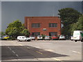
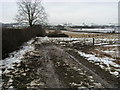
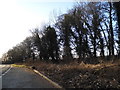
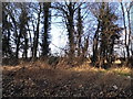


10 photos from this area
Area Information
Key information about the HP17 8SU including its size, population, and administrative classification.
- Area Type
- Postcode
- Area Size
- 4.5 hectares
- Population
- 1965
- Population Density
- 1013 people/km²
House Prices in HP17 8SU
25
Properties
£889,071
Average Sold Price
£380,000
Lowest Price
£1,150,000
Highest Price
Showing 25 properties
| Address | Type | Beds | Baths | Last Sale Price | Last Sale Date | |
|---|---|---|---|---|---|---|
| 14 Platers Road, Haddenham, HP17 8SU | Detached | 5 | 5 | £1,090,000 | Jun 2025 | |
| 10 Platers Road, Haddenham, HP17 8SU | Retail | 5 | 3 | £1,150,000 | Jun 2022 | |
| 12 Platers Road, Haddenham, HP17 8SU | house | - | - | £835,000 | Jul 2018 | |
| 29 Platers Road, Haddenham, HP17 8SU | house | - | - | £810,000 | Jun 2018 | |
| 8 Platers Road, Haddenham, HP17 8SU | house | - | - | £870,000 | Jun 2018 | |
| 33 Platers Road, Haddenham, HP17 8SU | house | - | - | £875,000 | Jun 2018 | |
| 31 Platers Road, Haddenham, HP17 8SU | house | - | - | £950,000 | Apr 2018 | |
| 2 Platers Road, Haddenham, HP17 8SU | house | - | - | £860,000 | Mar 2018 | |
| 6 Platers Road, Haddenham, HP17 8SU | house | - | - | £899,950 | Mar 2018 | |
| 25 Platers Road, Haddenham, HP17 8SU | house | - | - | £900,000 | Feb 2018 |
Page 1 of 3
Energy Efficiency in HP17 8SU
Amenities
Schools
| Rank | School | Type | Entry gender | Ages |
|---|
Explore more schools in this area
Go to Schools tabDemographics
Household Size
Two person
most common
Accommodation Type
Houses
most common
Tenure
82
majority
Ethnic Group
White
most common
Religion
N/A
most common
Household Composition
N/A
most common
Age
47
median
Adults (30-64 years)
most common
Household Deprivation
N/A
with no deprivation
NS-SEC
55
in Lower managerial occupations
Explore more demographic insights in this area
Go to Demographics tabPlanning
Planning Constraints
- Flood RiskPremium
- Ramsar Wetland SitesPremium
- Area of Outstanding Natural BeautyPremium
- Protected Nature ReservePremium
- Protected WoodlandPremium