Area Overview for HP17 8QX
Photos of HP17 8QX
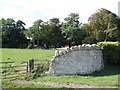
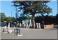
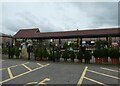
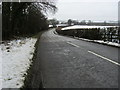
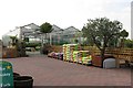
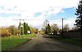
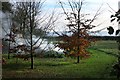
7 photos from this area
Area Information
Key information about the HP17 8QX including its size, population, and administrative classification.
- Area Type
- Postcode
- Area Size
- 24.9 hectares
- Population
- 1598
- Population Density
- 309 people/km²
House Prices in HP17 8QX
36
Properties
£460,244
Average Sold Price
£75,000
Lowest Price
£990,000
Highest Price
Showing 36 properties
| Address | Type | Beds | Baths | Last Sale Price | Last Sale Date | |
|---|---|---|---|---|---|---|
| 5 Bishopstone Road, Stone, HP17 8QX | Semi-detached | 2 | 1 | £313,900 | Feb 2025 | |
| 32 Bishopstone Road, Stone, HP17 8QX | Detached | 4 | 3 | £950,000 | Feb 2024 | |
| 23 Bishopstone Road, Stone, HP17 8QX | Terraced | 2 | 1 | £330,000 | Aug 2022 | |
| 19 Bishopstone Road, Stone, HP17 8QX | Bungalow | 2 | 1 | £325,000 | Dec 2021 | |
| 11 Bishopstone Road, Stone, HP17 8QX | house | - | - | £500,000 | Nov 2021 | |
| Maple View, Bishopstone Road, Stone, HP17 8QX | Detached | 5 | 3 | £865,000 | Feb 2020 | |
| Fair View House, Bishopstone Road, Stone, HP17 8QX | Detached | 5 | 3 | £815,000 | Jul 2018 | |
| 30 Bishopstone Road, Stone, HP17 8QX | Cottage | 3 | 2 | £440,000 | Oct 2017 | |
| The Goat House, 42 Bishopstone Road, Stone, HP17 8QX | Detached | - | - | £990,000 | May 2017 | |
| 36 Bishopstone Road, Stone, HP17 8QX | Bungalow | 2 | - | £338,000 | Apr 2012 |
Page 1 of 4
Energy Efficiency in HP17 8QX
Amenities
Schools
| Rank | School | Type | Entry gender | Ages |
|---|
Explore more schools in this area
Go to Schools tabDemographics
Household Size
Family (3-5 people)
most common
Accommodation Type
Houses
most common
Tenure
78
majority
Ethnic Group
White
most common
Religion
N/A
most common
Household Composition
N/A
most common
Age
47
median
Adults (30-64 years)
most common
Household Deprivation
N/A
with no deprivation
NS-SEC
45
in Lower managerial occupations
Explore more demographic insights in this area
Go to Demographics tabPlanning
Planning Constraints
- Flood RiskPremium
- Ramsar Wetland SitesPremium
- Area of Outstanding Natural BeautyPremium
- Protected Nature ReservePremium
- Protected WoodlandPremium