Area Overview for HP17 0UE
Photos of HP17 0UE
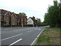
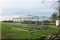
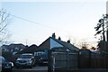

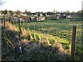
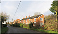
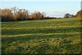

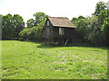
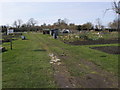
11 photos from this area
Area Information
Key information about the HP17 0UE including its size, population, and administrative classification.
- Area Type
- Postcode
- Area Size
- 99.1 hectares
- Population
- 1496
- Population Density
- 72 people/km²
House Prices in HP17 0UE
32
Properties
£816,935
Average Sold Price
£199,950
Lowest Price
£2,400,000
Highest Price
Showing 32 properties
| Address | Type | Beds | Baths | Last Sale Price | Last Sale Date | |
|---|---|---|---|---|---|---|
| The Red House, Risborough Road, Little Kimble, HP17 0UE | Detached | 4 | - | £830,000 | Oct 2020 | |
| The Glebe House, Risborough Road, Little Kimble, HP17 0UE | Detached | 5 | 3 | £2,400,000 | Jul 2019 | |
| Vine Cottage, Risborough Road, Little Kimble, HP17 0UE | house | 3 | 1 | £760,000 | May 2019 | |
| Pendragon, Risborough Road, Little Kimble, HP17 0UE | Detached | 4 | 5 | £950,000 | Aug 2018 | |
| Dingle Dell, Risborough Road, Little Kimble, HP17 0UE | Bungalow | 5 | 3 | £1,193,000 | Aug 2018 | |
| Rodney Cottage, Risborough Road, Little Kimble, HP17 0UE | Detached | 5 | - | £799,950 | Sep 2017 | |
| Blackberry Hill, Risborough Road, Little Kimble, HP17 0UE | Detached | 5 | - | £950,000 | Jul 2015 | |
| Donkey Hall, Risborough Road, Little Kimble, HP17 0UE | Semi-detached | 3 | 1 | £710,000 | Dec 2014 | |
| Mill Turn Cottage, Risborough Road, Little Kimble, HP17 0UE | house | 2 | - | £500,000 | Jan 2014 | |
| Bracken House, Risborough Road, Little Kimble, HP17 0UE | Detached | 5 | - | £630,000 | Aug 2011 |
Page 1 of 4
Energy Efficiency in HP17 0UE
Amenities
Schools
| Rank | School | Type | Entry gender | Ages |
|---|
Explore more schools in this area
Go to Schools tabDemographics
Household Size
Two person
most common
Accommodation Type
Houses
most common
Tenure
87
majority
Ethnic Group
White
most common
Religion
N/A
most common
Household Composition
N/A
most common
Age
47
median
Adults (30-64 years)
most common
Household Deprivation
N/A
with no deprivation
NS-SEC
51
in Lower managerial occupations
Explore more demographic insights in this area
Go to Demographics tabPlanning
Planning Constraints
- Flood RiskPremium
- Ramsar Wetland SitesPremium
- Area of Outstanding Natural BeautyPremium
- Protected Nature ReservePremium
- Protected WoodlandPremium