Area Overview for HP17 0LD
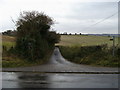
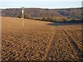
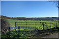
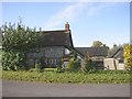
Photos of HP17 0LD

Area Information
Living in HP17 0LD means inhabiting a tightly knit residential cluster in England, where 1,482 people reside across a densely populated area of 1.29 km². This postcode is defined by its compact nature, with homes predominantly in the form of detached or semi-detached houses. The area’s character is shaped by its proximity to Princes Risborough, a nearby village offering a mix of local amenities and transport links. Daily life here is influenced by a mature population, with a median age of 47 and a strong presence of adults aged 30–64. The community is largely home-owning, with 73% of residents owning their properties. While the area lacks sprawling green spaces or major urban infrastructure, its appeal lies in its accessibility to nearby schools, rail networks, and retail hubs. For those seeking a balance between rural tranquillity and practical connectivity, HP17 0LD offers a snapshot of small-town living with a focus on stability and established neighbourhoods.
- Area Type
- Postcode
- Area Size
- Not available
- Population
- 1482
- Population Density
- 1153 people/km²
The property market in HP17 0LD is characterised by a high rate of home ownership, with 73% of residents living in owner-occupied homes. This indicates a stable, long-term resident base rather than a transient rental market. The accommodation type is overwhelmingly houses, which are typically larger and more permanent than flats or apartments. Given the small size of the postcode area, the housing stock is limited, making this a niche market for buyers seeking established properties in a low-density setting. The focus on owner-occupation suggests that the area is less likely to attract investors or short-term renters. For buyers, this means fewer properties are available but those that are may offer strong long-term value. The compact nature of HP17 0LD also means that properties are likely to be in close proximity to local amenities, which could be a key selling point for families or professionals prioritising convenience.
House Prices in HP17 0LD
No properties found in this postcode.
Energy Efficiency in HP17 0LD
The lifestyle in HP17 0LD is shaped by its proximity to retail and transport hubs. The area’s five retail outlets, including M&S Princes Risborough and Asda Bell, provide access to everyday shopping needs, while the nearby railway stations offer connections to larger towns and cities. Though the data does not mention parks or leisure facilities, the presence of multiple rail stops suggests opportunities for weekend excursions or commuting to cultural centres. The community’s focus on homes rather than flats implies a preference for private outdoor spaces, though specific details on local green areas are absent. The mix of retail and transport options means that residents can balance local convenience with regional accessibility, making it suitable for those who value both self-sufficiency and connectivity.
Amenities
Schools
Residents of HP17 0LD have access to three schools within practical reach. Princes Risborough Primary School serves younger children, while Princes Risborough School and another academy cater to older students. One of the academies holds an Ofsted rating of ‘good’, reflecting a standard of education that meets regulatory benchmarks. The mix of primary and academy schools provides families with options, though the absence of further details on curriculum or performance means that parents would need to conduct additional research. The proximity of these schools to the area underscores its appeal to families seeking a settled environment with established educational facilities. However, the lack of information on school capacity or student numbers means that potential buyers should verify whether demand exceeds supply in the local education sector.
| Rank | School | Type | Entry gender | Ages |
|---|
Explore more schools in this area
Go to Schools tabDemographics
The population of HP17 0LD is predominantly composed of adults aged 30–64, reflecting a median age of 47. This suggests a community with a strong presence of middle-aged residents, likely including families and professionals. Home ownership is high, with 73% of properties owned by their occupants, indicating a stable housing market. The accommodation type is almost exclusively houses, which aligns with the area’s low population density and traditional residential layout. The predominant ethnic group is White, though no further breakdown of diversity is provided in the data. The absence of specific information on deprivation or socioeconomic variation means that the quality of life here is inferred from the availability of amenities and infrastructure. The age profile suggests a mature demographic, which may influence local services and community dynamics.
Household Size
Accommodation Type
Tenure
Ethnic Group
Religion
Household Composition
Age
Household Deprivation
NS-SEC
Explore more demographic insights in this area
Go to Demographics tabPlanning
Planning Constraints
- Flood RiskPremium
- Ramsar Wetland SitesPremium
- Area of Outstanding Natural BeautyPremium
- Protected Nature ReservePremium
- Protected WoodlandPremium