Area Overview for HP16 9DF
Photos of HP16 9DF
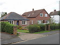
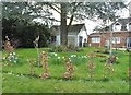
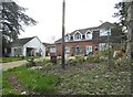
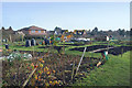
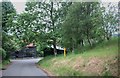
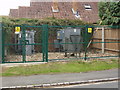
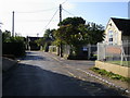
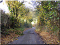
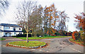
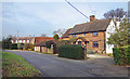
10 photos from this area
Area Information
Key information about the HP16 9DF including its size, population, and administrative classification.
- Area Type
- Postcode
- Area Size
- 4.6 hectares
- Population
- 1587
- Population Density
- 1205 people/km²
House Prices in HP16 9DF
22
Properties
£632,540
Average Sold Price
£125,000
Lowest Price
£1,206,000
Highest Price
Showing 22 properties
| Address | Type | Beds | Baths | Last Sale Price | Last Sale Date | |
|---|---|---|---|---|---|---|
| Moat Cottage, Moat Lane, Prestwood, HP16 9DF | Detached | 4 | 2 | £1,200,000 | Nov 2022 | |
| Foulden Vale, Moat Lane, Prestwood, HP16 9DF | house | - | - | £930,000 | Feb 2021 | |
| The Paddock, Moat Lane, Prestwood, HP16 9DF | Detached | 3 | 3 | £580,000 | Mar 2020 | |
| Swallowfield, Moat Lane, Prestwood, HP16 9DF | house | - | - | £890,000 | Feb 2020 | |
| Moat Farm, Moat Lane, Prestwood, HP16 9DF | Detached | - | - | £1,206,000 | Apr 2017 | |
| The Shieling, Moat Lane, Prestwood, HP16 9DF | Detached | - | - | £659,000 | Nov 2007 | |
| The Haven, Moat Lane, Prestwood, HP16 9DF | house | - | - | £558,000 | Oct 2004 | |
| Shalimar, Moat Lane, Prestwood, HP16 9DF | Detached | - | - | £269,440 | Mar 2004 | |
| Llanberis, Moat Lane, Prestwood, HP16 9DF | house | - | - | £292,000 | Jan 2004 | |
| Moat Lodge, Moat Lane, Prestwood, HP16 9DF | Detached | - | - | £248,500 | Nov 1998 |
Page 1 of 3
Energy Efficiency in HP16 9DF
Amenities
Schools
| Rank | School | Type | Entry gender | Ages |
|---|
Explore more schools in this area
Go to Schools tabDemographics
Household Size
Two person
most common
Accommodation Type
Houses
most common
Tenure
91
majority
Ethnic Group
White
most common
Religion
N/A
most common
Household Composition
N/A
most common
Age
47
median
Adults (30-64 years)
most common
Household Deprivation
N/A
with no deprivation
NS-SEC
52
in Lower managerial occupations
Explore more demographic insights in this area
Go to Demographics tabPlanning
Planning Constraints
- Flood RiskPremium
- Ramsar Wetland SitesPremium
- Area of Outstanding Natural BeautyPremium
- Protected Nature ReservePremium
- Protected WoodlandPremium