Area Overview for HP15 7UP
Photos of HP15 7UP
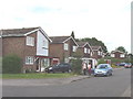
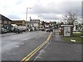
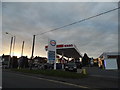
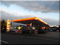
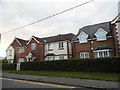
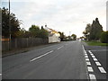
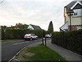
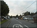
24 photos from this area
Area Information
Key information about the HP15 7UP including its size, population, and administrative classification.
- Area Type
- Postcode
- Area Size
- 5792 m²
- Population
- 1392
- Population Density
- 6901 people/km²
House Prices in HP15 7UP
13
Properties
£247,583
Average Sold Price
£87,750
Lowest Price
£420,000
Highest Price
Showing 13 properties
| Address | Type | Beds | Baths | Last Sale Price | Last Sale Date | |
|---|---|---|---|---|---|---|
| 97 Rose Avenue, Hazlemere, HP15 7UP | Terraced | 3 | 1 | £420,000 | Jan 2023 | |
| 109 Rose Avenue, Hazlemere, HP15 7UP | house | 3 | 1 | £415,000 | Jun 2022 | |
| 91 Rose Avenue, Hazlemere, HP15 7UP | Flat | 3 | 1 | £240,000 | Sep 2015 | |
| Gatehouse, 101A Rose Avenue, Hazlemere, HP15 7UP | house | 4 | - | £375,000 | Feb 2011 | |
| 99 Rose Avenue, Hazlemere, HP15 7UP | Terraced | 3 | 1 | £228,000 | Dec 2010 | |
| 103 Rose Avenue, Hazlemere, HP15 7UP | house | 3 | - | £219,000 | Apr 2006 | |
| 111 Rose Avenue, Hazlemere, HP15 7UP | Terraced | 3 | 1 | £138,000 | Jul 2001 | |
| 107 Rose Avenue, Hazlemere, HP15 7UP | Terraced | - | - | £105,500 | Sep 1999 | |
| 105 Rose Avenue, Hazlemere, HP15 7UP | Terraced | - | - | £87,750 | Aug 1997 | |
| 93 Rose Avenue, Hazlemere, HP15 7UP | Flat | - | - | - | - |
Page 1 of 2
Energy Efficiency in HP15 7UP
Amenities
Schools
| Rank | School | Type | Entry gender | Ages |
|---|
Explore more schools in this area
Go to Schools tabDemographics
Household Size
One person
most common
Accommodation Type
Houses
most common
Tenure
72
majority
Ethnic Group
White
most common
Religion
N/A
most common
Household Composition
N/A
most common
Age
47
median
Adults (30-64 years)
most common
Household Deprivation
N/A
with no deprivation
NS-SEC
39
in Lower managerial occupations
Explore more demographic insights in this area
Go to Demographics tabPlanning
Planning Constraints
- Flood RiskPremium
- Ramsar Wetland SitesPremium
- Area of Outstanding Natural BeautyPremium
- Protected Nature ReservePremium
- Protected WoodlandPremium