Area Overview for HP15 6PA
Photos of HP15 6PA
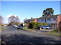
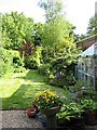
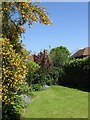
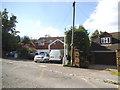
17 photos from this area
Area Information
Key information about the HP15 6PA including its size, population, and administrative classification.
- Area Type
- Postcode
- Area Size
- 1.8 hectares
- Population
- 1366
- Population Density
- 873 people/km²
House Prices in HP15 6PA
39
Properties
£346,187
Average Sold Price
£42,000
Lowest Price
£630,000
Highest Price
Showing 39 properties
| Address | Type | Beds | Baths | Last Sale Price | Last Sale Date | |
|---|---|---|---|---|---|---|
| Crest House, Sunny Bank, Widmer End, HP15 6PA | Detached | 4 | 2 | £630,000 | Jul 2025 | |
| 18 Sunny Bank, Widmer End, HP15 6PA | Semi-detached | 4 | 2 | £551,000 | Jan 2025 | |
| 3 Sunny Bank, Widmer End, HP15 6PA | Detached | 4 | 1 | £499,950 | Dec 2018 | |
| 33 Sunny Bank, Widmer End, HP15 6PA | Detached | 4 | 2 | £500,000 | Sep 2017 | |
| 32 Sunny Bank, Widmer End, HP15 6PA | house | - | - | £450,000 | Nov 2015 | |
| 34 Sunny Bank, Widmer End, HP15 6PA | Detached | 4 | 2 | £475,000 | Oct 2015 | |
| 22 Sunny Bank, Widmer End, HP15 6PA | house | - | - | £385,000 | Aug 2014 | |
| 26 Sunny Bank, Widmer End, HP15 6PA | Detached | 4 | 2 | £380,000 | Jun 2014 | |
| Gable End, 41 Sunny Bank, Widmer End, HP15 6PA | Detached | 4 | - | £479,950 | Sep 2013 | |
| 40A Sunny Bank, Widmer End, HP15 6PA | house | 4 | - | £332,000 | Apr 2011 |
Page 1 of 4
Energy Efficiency in HP15 6PA
Amenities
Schools
| Rank | School | Type | Entry gender | Ages |
|---|
Explore more schools in this area
Go to Schools tabDemographics
Household Size
Family (3-5 people)
most common
Accommodation Type
Houses
most common
Tenure
91
majority
Ethnic Group
White
most common
Religion
N/A
most common
Household Composition
N/A
most common
Age
47
median
Adults (30-64 years)
most common
Household Deprivation
N/A
with no deprivation
NS-SEC
46
in Lower managerial occupations
Explore more demographic insights in this area
Go to Demographics tabPlanning
Planning Constraints
- Flood RiskPremium
- Ramsar Wetland SitesPremium
- Area of Outstanding Natural BeautyPremium
- Protected Nature ReservePremium
- Protected WoodlandPremium