Area Overview for HP14 4SG
Photos of HP14 4SG
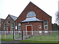
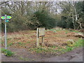
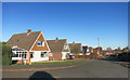
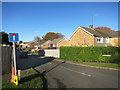
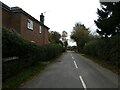
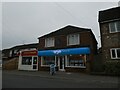

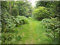


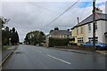
12 photos from this area
Area Information
Key information about the HP14 4SG including its size, population, and administrative classification.
- Area Type
- Postcode
- Area Size
- 1.0 hectares
- Population
- 1557
- Population Density
- 290 people/km²
House Prices in HP14 4SG
17
Properties
£488,167
Average Sold Price
£259,500
Lowest Price
£1,150,000
Highest Price
Showing 17 properties
| Address | Type | Beds | Baths | Last Sale Price | Last Sale Date | |
|---|---|---|---|---|---|---|
| The Firs, Purssells Meadow, Naphill, HP14 4SG | Bungalow | 2 | 1 | £1,150,000 | May 2023 | |
| Maple Lea, Purssells Meadow, Naphill, HP14 4SG | house | - | - | £540,000 | Oct 2021 | |
| Wedgewood, Purssells Meadow, Naphill, HP14 4SG | Bungalow | 3 | 1 | £492,000 | Mar 2020 | |
| Catalpa, Purssells Meadow, Naphill, HP14 4SG | Detached | 4 | 2 | £670,000 | Oct 2018 | |
| Aldin, Purssells Meadow, Naphill, HP14 4SG | Semi-detached | 3 | 1 | £422,000 | Oct 2015 | |
| Ashley, Purssells Meadow, Naphill, HP14 4SG | Bungalow | 2 | - | £395,000 | Sep 2015 | |
| Caprice, Purssells Meadow, Naphill, HP14 4SG | Semi-detached | 4 | - | £500,000 | Nov 2014 | |
| The Beeches, Purssells Meadow, Naphill, HP14 4SG | house | 4 | - | £440,000 | Feb 2011 | |
| Seletar, 6 Purssells Meadow, Naphill, HP14 4SG | Semi-detached | - | - | £259,500 | Oct 2005 | |
| Westholme, Purssells Meadow, Naphill, HP14 4SG | Bungalow | 2 | - | £297,000 | Sep 2004 |
Page 1 of 2
Energy Efficiency in HP14 4SG
Amenities
Schools
| Rank | School | Type | Entry gender | Ages |
|---|
Explore more schools in this area
Go to Schools tabDemographics
Household Size
Two person
most common
Accommodation Type
Houses
most common
Tenure
92
majority
Ethnic Group
White
most common
Religion
N/A
most common
Household Composition
N/A
most common
Age
47
median
Adults (30-64 years)
most common
Household Deprivation
N/A
with no deprivation
NS-SEC
48
in Lower managerial occupations
Explore more demographic insights in this area
Go to Demographics tabPlanning
Planning Constraints
- Flood RiskPremium
- Ramsar Wetland SitesPremium
- Area of Outstanding Natural BeautyPremium
- Protected Nature ReservePremium
- Protected WoodlandPremium