Area Overview for HP14 4SD
Photos of HP14 4SD

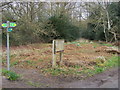
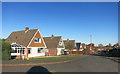
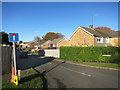
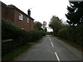
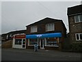
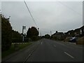
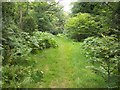

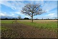
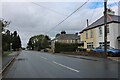
12 photos from this area
Area Information
Key information about the HP14 4SD including its size, population, and administrative classification.
- Area Type
- Postcode
- Area Size
- 1.0 hectares
- Population
- 1373
- Population Density
- 1277 people/km²
House Prices in HP14 4SD
20
Properties
£282,242
Average Sold Price
£123,500
Lowest Price
£490,000
Highest Price
Showing 20 properties
| Address | Type | Beds | Baths | Last Sale Price | Last Sale Date | |
|---|---|---|---|---|---|---|
| 189 Main Road, Naphill, HP14 4SD | house | - | - | £450,000 | Sep 2022 | |
| 185 Main Road, Naphill, HP14 4SD | Semi-detached | 3 | 2 | £490,000 | Aug 2022 | |
| 167 Main Road, Naphill, HP14 4SD | Detached | - | - | £320,000 | Jun 2003 | |
| 187 Main Road, Naphill, HP14 4SD | Terraced | - | - | £180,000 | May 2001 | |
| 191 Main Road, Naphill, HP14 4SD | Semi-detached | - | - | £129,950 | Jul 1997 | |
| 191A Main Road, Naphill, HP14 4SD | Semi-detached | - | - | £123,500 | Nov 1996 | |
| 185A Main Road, Naphill, HP14 4SD | Semi-detached | 3 | 2 | - | - | |
| 187A Main Road, Naphill, HP14 4SD | Terraced | 3 | 2 | - | - | |
| 165 Main Road, Naphill, HP14 4SD | Detached | 3 | 2 | - | - | |
| 173 Main Road, Naphill, HP14 4SD | undefined | - | - | - | - |
Page 1 of 2
Energy Efficiency in HP14 4SD
Amenities
Schools
| Rank | School | Type | Entry gender | Ages |
|---|
Explore more schools in this area
Go to Schools tabDemographics
Household Size
Family (3-5 people)
most common
Accommodation Type
Houses
most common
Tenure
64
majority
Ethnic Group
White
most common
Religion
N/A
most common
Household Composition
N/A
most common
Age
47
median
Adults (30-64 years)
most common
Household Deprivation
N/A
with no deprivation
NS-SEC
43
in Lower managerial occupations
Explore more demographic insights in this area
Go to Demographics tabPlanning
Planning Constraints
- Flood RiskPremium
- Ramsar Wetland SitesPremium
- Area of Outstanding Natural BeautyPremium
- Protected Nature ReservePremium
- Protected WoodlandPremium