Area Overview for HP14 4PL
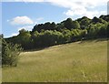
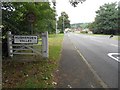
Photos of HP14 4PL
Area Information
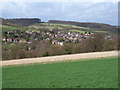
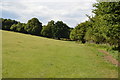
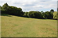
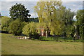
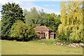
Living in HP14 4PL means being part of a compact, residential cluster in England, home to 1,171 people spread across 258 people per square kilometre. This small postcode area is defined by its proximity to essential services and transport links, making it a practical choice for those seeking a balance between convenience and tranquillity. The area’s density suggests a tight-knit community, where local amenities and schools are within easy reach. Residents benefit from proximity to High Wycombe and Great Missenden railway stations, offering straightforward access to London and surrounding towns. The presence of nearby schools, including Great Kingshill Church of England Combined School, which operates as both a primary and academy, highlights the area’s appeal to families. Daily life here is shaped by the mix of retail options, from local shops like Spar and Co-op Downley to larger stores such as Tesco Plomer. The area’s low crime risk and absence of environmental constraints, such as protected woodlands or AONB designations, further enhance its appeal for homebuyers seeking a stable, low-maintenance environment.
- Area Type
- Postcode
- Area Size
- Not available
- Population
- 1171
- Population Density
- 258 people/km²
The property market in HP14 4PL reflects its small scale and residential focus. While specific home ownership percentages are not provided, the area’s compact nature suggests a mix of owner-occupied properties and rental units, typical of smaller postcode clusters. The housing stock likely includes a range of accommodation types, from terraced homes to semi-detached properties, catering to both families and individuals. Given the area’s proximity to transport links and amenities, it may attract buyers looking for a base near commuter routes or for those seeking a quieter alternative to larger towns. However, the limited size of HP14 4PL means the immediate surroundings are critical for buyers considering local housing options. The absence of significant planning constraints, such as protected nature reserves or Ramsar wetlands, may also make the area more attractive for development or investment.
House Prices in HP14 4PL
No properties found in this postcode.
Energy Efficiency in HP14 4PL
The lifestyle in HP14 4PL is shaped by its proximity to a variety of amenities. Local retail options include Spar, Co-op Downley, and Tesco Plomer, offering everyday essentials. The area’s rail stations connect residents to broader networks, enabling access to larger towns and cities for more specialised shopping or dining. While specific parks or leisure facilities are not listed in the data, the absence of environmental constraints suggests open spaces may be available nearby. The compact nature of the area means daily errands and social activities can be managed locally, fostering a sense of convenience. The blend of retail and transport options supports a practical, community-oriented lifestyle, ideal for those prioritising accessibility over sprawling urban amenities.
Amenities
Schools
Residents of HP14 4PL have access to Great Kingshill Church of England Combined School, which serves as both a primary school and an academy. This dual designation indicates a blend of traditional and potentially more flexible educational approaches, offering families a range of options. As a combined school, it caters to both primary and secondary education, reducing the need for students to commute to other areas for secondary schooling. The presence of a single notable school within the postcode suggests a focused educational landscape, though families may need to look slightly beyond HP14 4PL for additional secondary options. The school’s role as an academy may imply a degree of autonomy in curriculum and governance, which could be a consideration for parents prioritising specific educational philosophies.
| Rank | School | Type | Entry gender | Ages |
|---|
Explore more schools in this area
Go to Schools tabDemographics
Household Size
Accommodation Type
Tenure
Ethnic Group
Religion
Household Composition
Age
Household Deprivation
NS-SEC
Explore more demographic insights in this area
Go to Demographics tabPlanning
Planning Constraints
- Flood RiskPremium
- Ramsar Wetland SitesPremium
- Area of Outstanding Natural BeautyPremium
- Protected Nature ReservePremium
- Protected WoodlandPremium