Area Overview for HP14 4JT
Photos of HP14 4JT
Area Information
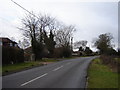
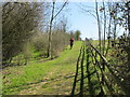
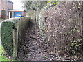
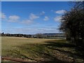
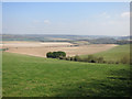
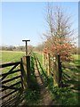
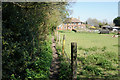
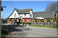
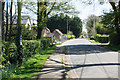
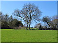
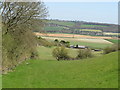
HP14 4JT is a small, tightly knit residential postcode area in England, covering just 18.2 hectares and home to 1,712 residents. Its compact size means it’s a quiet, low-density neighbourhood with a strong sense of local identity. The area’s proximity to natural landscapes is notable, as it lies within the Area of Outstanding Natural Beauty (AONB) designation, offering residents access to scenic surroundings. Daily life here is shaped by its rural character, with amenities like nearby railway stations and local shops within easy reach. The postcode’s small footprint ensures a close-knit community, where familiarity with neighbours is common. While the area lacks major urban hubs, its charm lies in its simplicity and connection to the countryside. For those seeking a peaceful, low-traffic environment with natural beauty, HP14 4JT provides a distinct alternative to busier centres. The combination of low crime risk and minimal environmental constraints makes it an appealing choice for buyers prioritising safety and tranquillity.
- Area Type
- Postcode
- Area Size
- 18.2 hectares
- Population
- 1712
- Population Density
- 155 people/km²
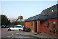
HP14 4JT’s property market is shaped by its small, residential nature. The area’s limited size means housing stock is likely to be modest in scale, with a focus on single-family homes or small detached properties. While specific data on home ownership rates or accommodation types is not provided, the postcode’s classification as a “small residential cluster” suggests a predominance of owner-occupied properties rather than rental units. Buyers should expect a limited selection of homes, given the area’s compact footprint. The proximity to rail services and natural landscapes may make it attractive to those prioritising location over property size. However, the lack of major urban infrastructure means the market is likely to cater to buyers seeking tranquillity and a connection to the countryside rather than high-density living.
House Prices in HP14 4JT
Showing 1 properties
| Address | Type | Beds | Baths | Last Sale Price | Last Sale Date | |
|---|---|---|---|---|---|---|
| The Dairy, Haw Lane, Bledlow Ridge, HP14 4JT | Detached | - | - | £350,000 | Jan 1998 |
Energy Efficiency in HP14 4JT
Daily life in HP14 4JT is centred around its rural setting and proximity to essential amenities. Residents can access five retail outlets, including Co-op Walters and Tesco Stokenchurch, for groceries and everyday purchases. The area’s inclusion in an AONB means natural scenery is a key feature, though specific parks or leisure facilities are not listed in the data. The five railway stations provide links to nearby towns, supporting both commuting and travel. The Wycombe Air Park adds a unique element for those needing air travel. While the area lacks large-scale entertainment options, its low density and quiet environment cater to those seeking a slower pace of life. The combination of practical amenities and natural surroundings defines the lifestyle here.
Amenities
Schools
The nearest school to HP14 4JT is Bledlow Ridge School, a primary school with a Good Ofsted rating. This single school serves the local community, providing education for younger children in the area. The absence of secondary schools nearby means families with older children may need to look further afield, potentially increasing commuting times. However, the Good rating at Bledlow Ridge School suggests a reliable standard of education for primary-level students. The limited number of schools in the immediate vicinity reflects the area’s small size and rural character, which may appeal to those prioritising a quiet, family-friendly environment over extensive educational facilities.
| Rank | School | Type | Entry gender | Ages |
|---|
Explore more schools in this area
Go to Schools tabDemographics
The population of HP14 4JT is 1,712, spread across 18.2 hectares, resulting in a density of 155 people per square kilometre. This figure suggests a sparsely populated, rural setting with ample open space. While specific data on age distribution or household composition is not available, the area’s small size and low density imply a mix of family homes and possibly some second homes. The absence of detailed demographic breakdowns means broader assumptions about the community’s structure are not possible. However, the area’s inclusion within an AONB and proximity to rail services suggest it may attract residents seeking a balance between countryside living and access to transport. The low crime risk score of 86/100 further indicates a safe, stable environment, which could appeal to a range of household types.
Household Size
Accommodation Type
Tenure
Ethnic Group
Religion
Household Composition
Age
Household Deprivation
NS-SEC
Explore more demographic insights in this area
Go to Demographics tabPlanning
Planning Constraints
- Flood RiskPremium
- Ramsar Wetland SitesPremium
- Area of Outstanding Natural BeautyPremium
- Protected Nature ReservePremium
- Protected WoodlandPremium