Area Overview for HP14 4JJ
Photos of HP14 4JJ
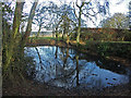
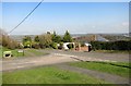
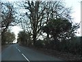
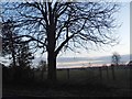
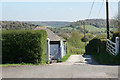
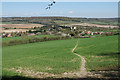
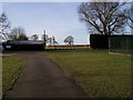
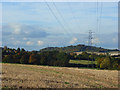
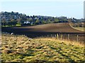
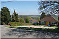
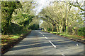
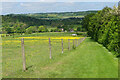
13 photos from this area
Area Information
Key information about the HP14 4JJ including its size, population, and administrative classification.
- Area Type
- Postcode
- Area Size
- 14.4 hectares
- Population
- 1712
- Population Density
- 155 people/km²
House Prices in HP14 4JJ
29
Properties
£595,188
Average Sold Price
£197,500
Lowest Price
£1,840,000
Highest Price
Showing 29 properties
| Address | Type | Beds | Baths | Last Sale Price | Last Sale Date | |
|---|---|---|---|---|---|---|
| The Lookout, 36 Haw Lane, Bledlow Ridge, HP14 4JJ | Detached | 4 | 2 | £952,500 | Jan 2025 | |
| 58 Haw Lane, Bledlow Ridge, HP14 4JJ | house | 6 | - | £1,840,000 | Nov 2022 | |
| 52 Haw Lane, Bledlow Ridge, HP14 4JJ | Detached | 3 | 2 | £785,000 | Jun 2019 | |
| Site Of 9, Haw Lane, Bledlow Ridge, HP14 4JJ | house | 3 | 1 | £625,000 | Aug 2017 | |
| 38 Haw Lane, Bledlow Ridge, HP14 4JJ | Detached | 3 | - | £582,500 | Apr 2017 | |
| 7 Haw Lane, Bledlow Ridge, HP14 4JJ | Detached | 5 | - | £560,000 | Jun 2015 | |
| Robin Star, 34 Haw Lane, Bledlow Ridge, HP14 4JJ | house | 4 | - | £547,000 | Jul 2013 | |
| 26 Haw Lane, Bledlow Ridge, HP14 4JJ | Detached | - | - | £450,000 | Aug 2012 | |
| 28 Haw Lane, Bledlow Ridge, HP14 4JJ | house | 5 | - | £587,000 | Jul 2012 | |
| 42 Haw Lane, Bledlow Ridge, HP14 4JJ | house | 4 | - | £731,000 | Nov 2011 |
Page 1 of 3
Energy Efficiency in HP14 4JJ
Amenities
Schools
| Rank | School | Type | Entry gender | Ages |
|---|
Explore more schools in this area
Go to Schools tabDemographics
Household Size
Two person
most common
Accommodation Type
Houses
most common
Tenure
67
majority
Ethnic Group
White
most common
Religion
N/A
most common
Household Composition
N/A
most common
Age
47
median
Adults (30-64 years)
most common
Household Deprivation
N/A
with no deprivation
NS-SEC
55
in Lower managerial occupations
Explore more demographic insights in this area
Go to Demographics tabPlanning
Planning Constraints
- Flood RiskPremium
- Ramsar Wetland SitesPremium
- Area of Outstanding Natural BeautyPremium
- Protected Nature ReservePremium
- Protected WoodlandPremium