Area Overview for HP14 3SL
Photos of HP14 3SL
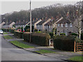
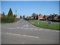
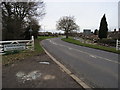
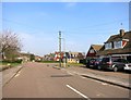
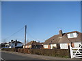
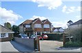
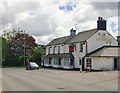
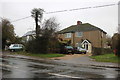
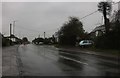
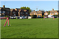
23 photos from this area
Area Information
Key information about the HP14 3SL including its size, population, and administrative classification.
- Area Type
- Postcode
- Area Size
- 4.5 hectares
- Population
- 1444
- Population Density
- 114 people/km²
House Prices in HP14 3SL
23
Properties
£271,056
Average Sold Price
£116,000
Lowest Price
£375,000
Highest Price
Showing 23 properties
| Address | Type | Beds | Baths | Last Sale Price | Last Sale Date | |
|---|---|---|---|---|---|---|
| 123 Marlow Road, Stokenchurch, HP14 3SL | Bungalow | 2 | 1 | £375,000 | Jul 2023 | |
| 89 Marlow Road, Stokenchurch, HP14 3SL | Bungalow | 2 | - | £310,000 | Jun 2021 | |
| 121 Marlow Road, Stokenchurch, HP14 3SL | Semi-detached | 2 | - | £330,000 | Oct 2018 | |
| 109 Marlow Road, Stokenchurch, HP14 3SL | Bungalow | 4 | - | £325,000 | Dec 2014 | |
| 97 Marlow Road, Stokenchurch, HP14 3SL | Semi-detached | 2 | - | £215,000 | Apr 2014 | |
| 99 Marlow Road, Stokenchurch, HP14 3SL | Bungalow | 2 | - | £247,500 | Apr 2011 | |
| 127 Marlow Road, Stokenchurch, HP14 3SL | Semi-detached | - | - | £249,950 | Apr 2007 | |
| 101 Marlow Road, Stokenchurch, HP14 3SL | Semi-detached | - | - | £116,000 | Feb 2002 | |
| 107 Marlow Road, Stokenchurch, HP14 3SL | Semi-detached | 2 | 1 | - | - | |
| 95 Marlow Road, Stokenchurch, HP14 3SL | Bungalow | 2 | 1 | - | - |
Page 1 of 3
Energy Efficiency in HP14 3SL
Amenities
Schools
| Rank | School | Type | Entry gender | Ages |
|---|
Explore more schools in this area
Go to Schools tabDemographics
Household Size
Family (3-5 people)
most common
Accommodation Type
Houses
most common
Tenure
79
majority
Ethnic Group
White
most common
Religion
N/A
most common
Household Composition
N/A
most common
Age
47
median
Adults (30-64 years)
most common
Household Deprivation
N/A
with no deprivation
NS-SEC
34
in Lower managerial occupations
Explore more demographic insights in this area
Go to Demographics tabPlanning
Planning Constraints
- Flood RiskPremium
- Ramsar Wetland SitesPremium
- Area of Outstanding Natural BeautyPremium
- Protected Nature ReservePremium
- Protected WoodlandPremium