Area Overview for HP14 3JU
Photos of HP14 3JU
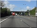
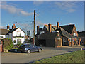

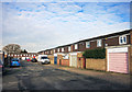
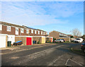
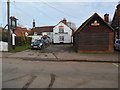
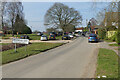

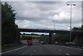
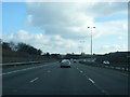
29 photos from this area
Area Information
Key information about the HP14 3JU including its size, population, and administrative classification.
- Area Type
- Postcode
- Area Size
- 2189 m²
- Population
- 1622
- Population Density
- 521 people/km²
House Prices in HP14 3JU
12
Properties
£295,619
Average Sold Price
£130,000
Lowest Price
£382,000
Highest Price
Showing 12 properties
| Address | Type | Beds | Baths | Last Sale Price | Last Sale Date | |
|---|---|---|---|---|---|---|
| 80 The Row, Lane End, HP14 3JU | Terraced | 2 | 1 | £337,500 | Oct 2025 | |
| 78 The Row, Lane End, HP14 3JU | Terraced | 3 | 2 | £370,000 | Oct 2022 | |
| 62 The Row, Lane End, HP14 3JU | house | 2 | 1 | £382,000 | May 2022 | |
| 76 The Row, Lane End, HP14 3JU | Cottage | 2 | 1 | £265,500 | Mar 2022 | |
| 72 The Row, Lane End, HP14 3JU | Terraced | 2 | 1 | £315,000 | Sep 2021 | |
| 70 The Row, Lane End, HP14 3JU | Terraced | 2 | - | £339,950 | Nov 2015 | |
| 60 The Row, Lane End, HP14 3JU | Terraced | - | - | £225,000 | Nov 2006 | |
| 82 The Row, Lane End, HP14 3JU | Terraced | - | - | £130,000 | Dec 1998 | |
| 62B The Row, Lane End, HP14 3JU | Detached | 3 | 2 | - | - | |
| 62A The Row, Lane End, HP14 3JU | Terraced | 2 | 1 | - | - |
Page 1 of 2
Energy Efficiency in HP14 3JU
Amenities
Schools
| Rank | School | Type | Entry gender | Ages |
|---|
Explore more schools in this area
Go to Schools tabDemographics
Household Size
Two person
most common
Accommodation Type
Houses
most common
Tenure
79
majority
Ethnic Group
White
most common
Religion
N/A
most common
Household Composition
N/A
most common
Age
47
median
Adults (30-64 years)
most common
Household Deprivation
N/A
with no deprivation
NS-SEC
45
in Lower managerial occupations
Explore more demographic insights in this area
Go to Demographics tabPlanning
Planning Constraints
- Flood RiskPremium
- Ramsar Wetland SitesPremium
- Area of Outstanding Natural BeautyPremium
- Protected Nature ReservePremium
- Protected WoodlandPremium