Area Overview for HP14 3EB
Photos of HP14 3EB
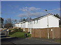
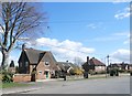
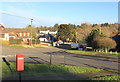
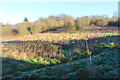
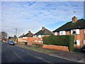
26 photos from this area
Area Information
Key information about the HP14 3EB including its size, population, and administrative classification.
- Area Type
- Postcode
- Area Size
- 1.2 hectares
- Population
- 1530
- Population Density
- 1011 people/km²
House Prices in HP14 3EB
28
Properties
£298,677
Average Sold Price
£129,950
Lowest Price
£562,000
Highest Price
Showing 28 properties
| Address | Type | Beds | Baths | Last Sale Price | Last Sale Date | |
|---|---|---|---|---|---|---|
| 31 Widdenton View, Lane End, HP14 3EB | Semi-detached | 3 | 2 | £562,000 | Jan 2025 | |
| 11 Widdenton View, Lane End, HP14 3EB | Semi-detached | 3 | 2 | £420,000 | May 2024 | |
| 21 Widdenton View, Lane End, HP14 3EB | house | - | - | £365,000 | Jun 2021 | |
| 49 Widdenton View, Lane End, HP14 3EB | house | - | - | £323,000 | Dec 2020 | |
| 45 Widdenton View, Lane End, HP14 3EB | Terraced | 3 | 1 | £295,000 | Aug 2018 | |
| 9 Widdenton View, Lane End, HP14 3EB | house | - | - | £330,000 | Jan 2016 | |
| 35 Widdenton View, Lane End, HP14 3EB | house | - | - | £310,000 | Jul 2014 | |
| 5 Widdenton View, Lane End, HP14 3EB | Detached | 3 | 1 | £220,000 | Jul 2006 | |
| 3 Widdenton View, Lane End, HP14 3EB | Semi-detached | - | - | £172,500 | Aug 2003 | |
| 17 Widdenton View, Lane End, HP14 3EB | Semi-detached | - | - | £158,000 | Aug 2002 |
Page 1 of 3
Energy Efficiency in HP14 3EB
Amenities
Schools
| Rank | School | Type | Entry gender | Ages |
|---|
Explore more schools in this area
Go to Schools tabDemographics
Household Size
Family (3-5 people)
most common
Accommodation Type
Houses
most common
Tenure
57
majority
Ethnic Group
White
most common
Religion
N/A
most common
Household Composition
N/A
most common
Age
47
median
Adults (30-64 years)
most common
Household Deprivation
N/A
with no deprivation
NS-SEC
32
in Lower managerial occupations
Explore more demographic insights in this area
Go to Demographics tabPlanning
Planning Constraints
- Flood RiskPremium
- Ramsar Wetland SitesPremium
- Area of Outstanding Natural BeautyPremium
- Protected Nature ReservePremium
- Protected WoodlandPremium