Area Overview for HP13 7HT
Photos of HP13 7HT
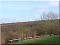
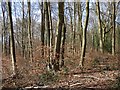
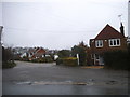
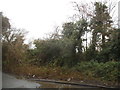

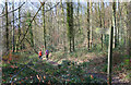
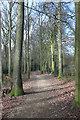
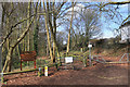

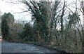
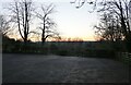

20 photos from this area
Area Information
Key information about the HP13 7HT including its size, population, and administrative classification.
- Area Type
- Postcode
- Area Size
- 1.4 hectares
- Population
- 1618
- Population Density
- 4640 people/km²
House Prices in HP13 7HT
35
Properties
£237,653
Average Sold Price
£79,950
Lowest Price
£385,000
Highest Price
Showing 35 properties
| Address | Type | Beds | Baths | Last Sale Price | Last Sale Date | |
|---|---|---|---|---|---|---|
| 240A Micklefield Road, High Wycombe, HP13 7HT | Detached | 3 | 1 | £385,000 | Jan 2024 | |
| 256 Micklefield Road, High Wycombe, HP13 7HT | Flat | - | - | £230,000 | Jun 2023 | |
| 286 Micklefield Road, High Wycombe, HP13 7HT | house | - | - | £346,000 | Sep 2021 | |
| 246 Micklefield Road, High Wycombe, HP13 7HT | house | - | - | £325,000 | Apr 2021 | |
| 250 Micklefield Road, High Wycombe, HP13 7HT | Semi-detached | 3 | 1 | £345,000 | Oct 2020 | |
| 254 Micklefield Road, High Wycombe, HP13 7HT | Semi-detached | 3 | 1 | £310,000 | Apr 2020 | |
| 266 Micklefield Road, High Wycombe, HP13 7HT | Terraced | 3 | 1 | £335,000 | May 2018 | |
| 236 Micklefield Road, High Wycombe, HP13 7HT | Semi-detached | 3 | 1 | £219,000 | May 2014 | |
| 268 Micklefield Road, High Wycombe, HP13 7HT | house | 3 | - | £173,000 | Dec 2013 | |
| 240 Micklefield Road, High Wycombe, HP13 7HT | Semi-detached | 3 | - | £190,000 | Apr 2013 |
Page 1 of 4
Energy Efficiency in HP13 7HT
Amenities
Schools
| Rank | School | Type | Entry gender | Ages |
|---|
Explore more schools in this area
Go to Schools tabDemographics
Household Size
Family (3-5 people)
most common
Accommodation Type
Houses
most common
Tenure
52
majority
Ethnic Group
White
most common
Religion
N/A
most common
Household Composition
N/A
most common
Age
47
median
Adults (30-64 years)
most common
Household Deprivation
N/A
with no deprivation
NS-SEC
27
in Lower managerial occupations
Explore more demographic insights in this area
Go to Demographics tabPlanning
Planning Constraints
- Flood RiskPremium
- Ramsar Wetland SitesPremium
- Area of Outstanding Natural BeautyPremium
- Protected Nature ReservePremium
- Protected WoodlandPremium