Area Overview for HP13 6XX
Photos of HP13 6XX
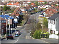
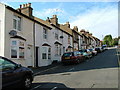
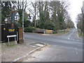
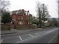
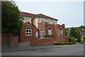
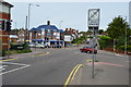
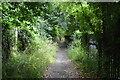
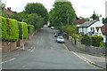
49 photos from this area
Area Information
Key information about the HP13 6XX including its size, population, and administrative classification.
- Area Type
- Postcode
- Area Size
- 1.1 hectares
- Population
- 2581
- Population Density
- 9355 people/km²
House Prices in HP13 6XX
30
Properties
£199,556
Average Sold Price
£55,000
Lowest Price
£370,000
Highest Price
Showing 30 properties
| Address | Type | Beds | Baths | Last Sale Price | Last Sale Date | |
|---|---|---|---|---|---|---|
| 32 Perth Road, High Wycombe, HP13 6XX | Semi-detached | 3 | 1 | £370,000 | Jun 2024 | |
| 4 Perth Road, High Wycombe, HP13 6XX | Semi-detached | 3 | 1 | £337,000 | Dec 2023 | |
| 21 Perth Road, High Wycombe, HP13 6XX | house | - | - | £330,000 | Dec 2020 | |
| 11 Perth Road, High Wycombe, HP13 6XX | Semi-detached | 3 | 1 | £312,500 | Oct 2020 | |
| 17 Perth Road, High Wycombe, HP13 6XX | Semi-detached | 3 | 1 | £292,000 | Mar 2020 | |
| 6 Perth Road, High Wycombe, HP13 6XX | Semi-detached | 3 | 1 | £280,000 | Dec 2015 | |
| 1 Perth Road, High Wycombe, HP13 6XX | Semi-detached | 3 | 1 | £234,000 | Dec 2005 | |
| 19 Perth Road, High Wycombe, HP13 6XX | Semi-detached | - | - | £235,000 | Oct 2005 | |
| 8 Perth Road, High Wycombe, HP13 6XX | house | - | - | £130,000 | Aug 2005 | |
| 30 Perth Road, High Wycombe, HP13 6XX | Semi-detached | 4 | 1 | £176,000 | Jun 2005 |
Page 1 of 3
Energy Efficiency in HP13 6XX
Amenities
Schools
| Rank | School | Type | Entry gender | Ages |
|---|
Explore more schools in this area
Go to Schools tabDemographics
Household Size
Family (3-5 people)
most common
Accommodation Type
Houses
most common
Tenure
76
majority
Ethnic Group
asian_total
most common
Religion
N/A
most common
Household Composition
N/A
most common
Age
47
median
Adults (30-64 years)
most common
Household Deprivation
N/A
with no deprivation
NS-SEC
25
in Lower managerial occupations
Explore more demographic insights in this area
Go to Demographics tabPlanning
Planning Constraints
- Flood RiskPremium
- Ramsar Wetland SitesPremium
- Area of Outstanding Natural BeautyPremium
- Protected Nature ReservePremium
- Protected WoodlandPremium