Area Overview for HP13 6PH
Photos of HP13 6PH
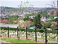
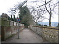
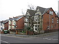
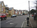
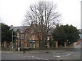
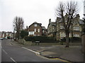
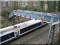
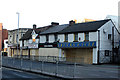
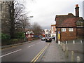
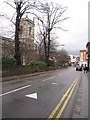
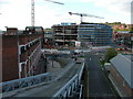
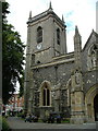
100 photos from this area
Area Information
Key information about the HP13 6PH including its size, population, and administrative classification.
- Area Type
- Postcode
- Area Size
- 3818 m²
- Population
- 1682
- Population Density
- 6858 people/km²
House Prices in HP13 6PH
18
Properties
£182,185
Average Sold Price
£77,400
Lowest Price
£297,500
Highest Price
Showing 18 properties
| Address | Type | Beds | Baths | Last Sale Price | Last Sale Date | |
|---|---|---|---|---|---|---|
| 11, Temple Orchard, Amersham Hill, High Wycombe, HP13 6PH | Flat | 2 | 1 | £290,000 | Oct 2022 | |
| 19, Temple Orchard, Amersham Hill, High Wycombe, HP13 6PH | Maisonette | 2 | 1 | £297,500 | Jul 2022 | |
| 14, Temple Orchard, Amersham Hill, High Wycombe, HP13 6PH | Maisonette | 2 | 1 | £250,000 | Sep 2018 | |
| 15, Temple Orchard, Amersham Hill, High Wycombe, HP13 6PH | Maisonette | 2 | 1 | £205,000 | Dec 2015 | |
| 10, Temple Orchard, Amersham Hill, High Wycombe, HP13 6PH | Flat | 2 | 1 | £176,000 | Sep 2010 | |
| 3, Temple Orchard, Amersham Hill, High Wycombe, HP13 6PH | Flat | 2 | 1 | £164,000 | Nov 2006 | |
| 4, Temple Orchard, Amersham Hill, High Wycombe, HP13 6PH | Maisonette | 2 | 1 | £167,000 | Sep 2006 | |
| 12, Temple Orchard, Amersham Hill, High Wycombe, HP13 6PH | Flat | 2 | 1 | £107,000 | Dec 2001 | |
| 2, Temple Orchard, Amersham Hill, High Wycombe, HP13 6PH | Flat | 2 | 1 | £87,950 | Jun 1999 | |
| 1, Temple Orchard, Amersham Hill, High Wycombe, HP13 6PH | Flat | 9 | 1 | £77,400 | Sep 1998 |
Page 1 of 2
Energy Efficiency in HP13 6PH
Amenities
Schools
| Rank | School | Type | Entry gender | Ages |
|---|
Explore more schools in this area
Go to Schools tabDemographics
Household Size
One person
most common
Accommodation Type
Flats
most common
Tenure
33
majority
Ethnic Group
White
most common
Religion
N/A
most common
Household Composition
N/A
most common
Age
47
median
Adults (30-64 years)
most common
Household Deprivation
N/A
with no deprivation
NS-SEC
35
in Lower managerial occupations
Explore more demographic insights in this area
Go to Demographics tabPlanning
Planning Constraints
- Flood RiskPremium
- Ramsar Wetland SitesPremium
- Area of Outstanding Natural BeautyPremium
- Protected Nature ReservePremium
- Protected WoodlandPremium